Lizemores, West Virginia
| Lizemores, West Virginia | |
|---|---|
| Unincorporated community | |
 Lizemores | |
| Coordinates: 38°20′02″N 81°10′30″W / 38.33389°N 81.17500°WCoordinates: 38°20′02″N 81°10′30″W / 38.33389°N 81.17500°W | |
| Country | United States |
| State | West Virginia |
| County | Clay |
| Elevation | 994 ft (303 m) |
| Time zone | UTC-5 (Eastern (EST)) |
| • Summer (DST) | UTC-4 (EDT) |
| ZIP code | 25125 |
| Area code(s) | 304 & 681 |
| GNIS feature ID | 1549788[1] |
Lizemores is an unincorporated community in Clay County, West Virginia, United States. Lizemores is located on West Virginia Route 16, 10 miles (16 km) southwest of Clay. Lizemores has a post office with ZIP code 25125.[2]
The community derives its name from the local Sizemore family (a recording error by postal officials accounts for the error in spelling, which was never corrected).[3]
References
- ↑ U.S. Geological Survey Geographic Names Information System: Lizemores, West Virginia
- ↑ ZIP Code Lookup
- ↑ Kenny, Hamill (1945). West Virginia Place Names: Their Origin and Meaning, Including the Nomenclature of the Streams and Mountains. Piedmont, WV: The Place Name Press. p. 379.
Municipalities and communities of Clay County, West Virginia, United States | ||
|---|---|---|
| Town | 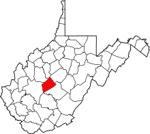 | |
| Unincorporated communities |
| |
| Footnotes | ‡This populated place also has portions in an adjacent county or counties | |
This article is issued from
Wikipedia.
The text is licensed under Creative Commons - Attribution - Sharealike.
Additional terms may apply for the media files.