| Name | Image | Year
built | Coordinates | Class of Light
[2] | Focal
height
[2] | NGA
number
[2] | Admiralty
number
[2] | Range
nml
[2] |
| Anse à la Barque Lighthouse | Image | 1886 est. | Basse-Terre
16°05′21.9″N 61°45′59.2″W / 16.089417°N 61.766444°W / 16.089417; -61.766444 | Fl (2) WRG 6s. | 11 metres (36 ft) | 14892 | J5712 | white: 8
red: 5
green: 5 |
| Bourg des Saintes Lighthouse |  | 1935 est. | Îles des Saintes
15°52′06.1″N 61°34′57.2″W / 15.868361°N 61.582556°W / 15.868361; -61.582556 | Fl WRG 4s. | 8 metres (26 ft) | 14904 | J5746 | white: 10
red: 7
green: 7 |
| Îlet du Gosier Lighthouse | .jpg) | 1928 | Le Gosier
16°11′54.2″N 61°29′26.7″W / 16.198389°N 61.490750°W / 16.198389; -61.490750 | Fl (2) R 10s. | 21 metres (69 ft) | 14860 | J5734 | 21 |
| La Désirade Lighthouse |  | 1933 est. | La Désirade
16°20′00.4″N 61°00′20.1″W / 16.333444°N 61.005583°W / 16.333444; -61.005583 | Fl (2) W 10s. | 20 metres (66 ft) | 14812 | J5724 | 20 |
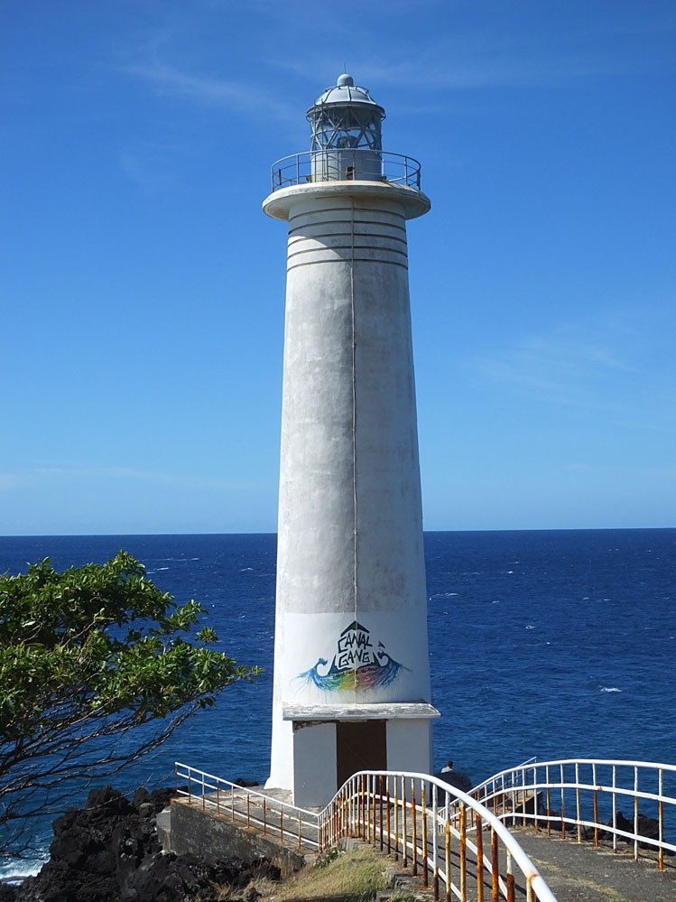
| Petite Terre Lighthouse |  | 1840 | Petite Terre Islands
16°10′14.4″N 61°06′33.5″W / 16.170667°N 61.109306°W / 16.170667; -61.109306 | Fl (3) W 12s. | 26 metres (85 ft) | 14832 | J5730 | 15 |
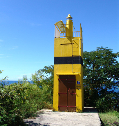
| Pointe de la Barque Lighthouse | Image | n/a | Marigot
16°05′24.4″N 61°46′17.4″W / 16.090111°N 61.771500°W / 16.090111; -61.771500 | Q (9) W 15s. | 7 metres (23 ft) | 14896 | J5710 | 9 |
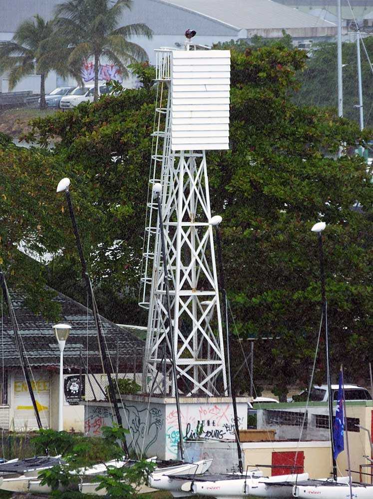
| Pointe-à-Pitre Range Front Lighthouse | Image | 1858 est. | Pointe-à-Pitre
16°13′11.9″N 61°31′54.2″W / 16.219972°N 61.531722°W / 16.219972; -61.531722 | Q W | 14 metres (46 ft) | 14864 | J5736 | 13 |
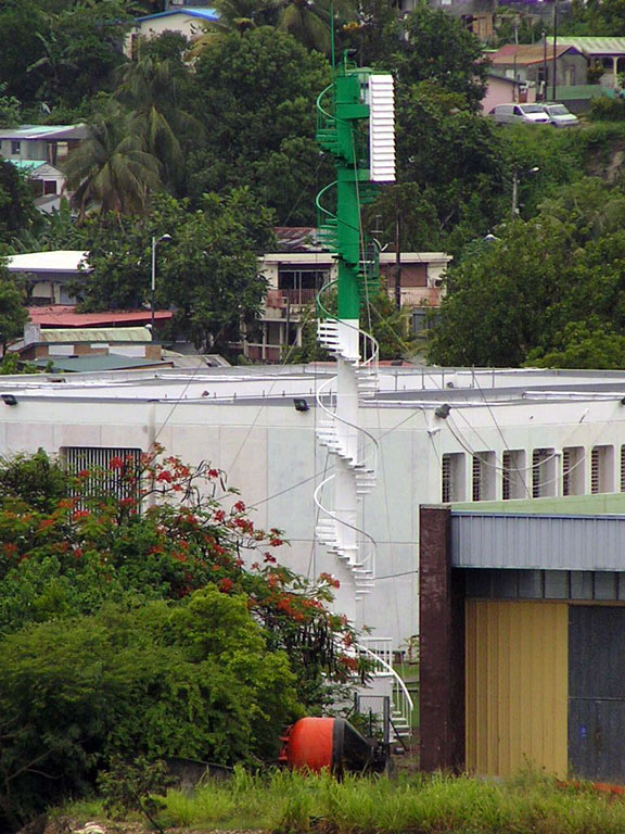
| Pointe-à-Pitre Range Rear Lighthouse | Image | 1883 est. | Pointe-à-Pitre
16°13′31.9″N 61°31′57.6″W / 16.225528°N 61.532667°W / 16.225528; -61.532667 | Q W | 20 metres (66 ft) | 14868 | J5736.1 | -- |
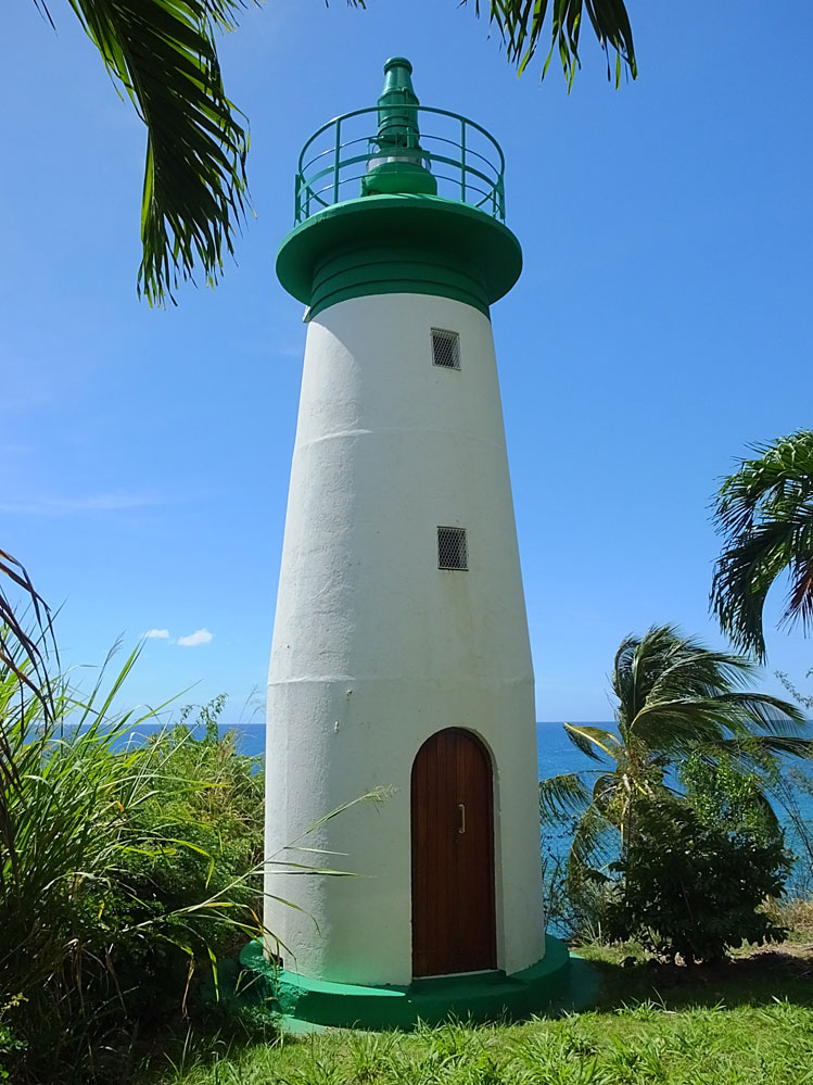
| Pointe du Vieux Fort Lighthouse |  | 1955 | Vieux-Fort
15°56′54.1″N 61°42′27.3″W / 15.948361°N 61.707583°W / 15.948361; -61.707583 | Fl (2+1) W 15s. | 23 metres (75 ft) | 14888 | J5704 | 22 |
| Port-Louis Lighthouse | Image | n/a | Port-Louis
16°25′05.4″N 61°32′01.1″W / 16.418167°N 61.533639°W / 16.418167; -61.533639 | Q (9) W 15s. | 10 metres (33 ft) | 14836 | J5716 | 11 |
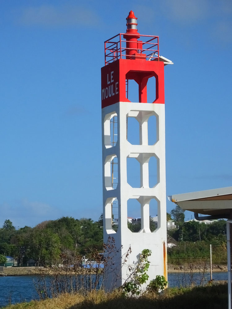
| Port du Moule Lighthouse | Image | n/a | Le Moule
16°19′56.6″N 61°20′35.9″W / 16.332389°N 61.343306°W / 16.332389; -61.343306 | Fl WR 4s. | 11 metres (36 ft) | 14844 | J5722 | white: 9
red : 6 |
| Port du Moule East Lighthouse | | n/a | Le Moule
16°19′58.5″N 61°20′24.6″W / 16.332917°N 61.340167°W / 16.332917; -61.340167 | Fl (2) WRG 6s. | 7 metres (23 ft) | 14848 | J5723 | white: 8
red: 6
green: 6 |
| Saint-Loius Lighthouse | Image | 1930 est. | Saint-Louis
15°57′24.5″N 61°19′08.2″W / 15.956806°N 61.318944°W / 15.956806; -61.318944 | Fl G 4s. | 9 metres (30 ft) | 14912 | J5750 | 9 |
| Trois-Rivières Lighthouse | Image | n/a | Trois-Rivières
15°58′10.1″N 61°38′47.4″W / 15.969472°N 61.646500°W / 15.969472; -61.646500 | Iso WRG | 9 metres (30 ft) | 14880 | J5702 | white: 10
red: 7
green: 7 |
|
_-_cropped.jpg)