| Monogram | Town | Description | Location |
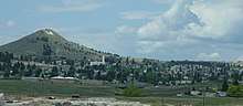
| Fish | Livingston | "Trout capital of the world" | 45°40′15″N 110°33′51″W / 45.6708°N 110.5641°W / 45.6708; -110.5641 ('Trout capital of the world') |
| h | Absarokee | | 45°31′02″N 109°26′15″W / 45.5172°N 109.4376°W / 45.5172; -109.4376 (Absarokee) |
| h | Anaconda | | 46°07′03″N 112°58′14″W / 46.1174°N 112.9706°W / 46.1174; -112.9706 (Anaconda) |
| h | Arlee | | 47°09′23″N 114°05′42″W / 47.156506°N 114.094879°W / 47.156506; -114.094879 (Arlee) |
| h (uncertain existence) | Baker | | 46°21′54″N 104°16′27″W / 46.3651°N 104.2741°W / 46.3651; -104.2741 (Baker) (uncertain location) |
| h | Dillon | Beaverhead County High School | 45°14′20″N 112°40′03″W / 45.2389°N 112.6676°W / 45.2389; -112.6676 (Barrett High School) |
| h | Bozeman | | 45°43′27″N 110°58′57″W / 45.7241°N 110.9825°W / 45.7241; -110.9825 (Bozeman) |
| h | Bridger | | 45°17′43″N 108°55′42″W / 45.295342°N 108.928286°W / 45.295342; -108.928286 (Bridger) |
| h | Broadus | | 45°26′52″N 105°24′39″W / 45.4479°N 105.4107°W / 45.4479; -105.4107 (Broadus) |
| h | Helena | Carroll College | 46°34′13″N 112°01′48″W / 46.5704°N 112.0299°W / 46.5704; -112.0299 (Carroll College) |
| h | Ekalaka | Carter County High School | 45°53′50″N 104°32′43″W / 45.8973°N 104.5453°W / 45.8973; -104.5453 (Carter Co. High School) |
| h | Cascade | | 47°16′53″N 111°42′37″W / 47.2815°N 111.7103°W / 47.2815; -111.7103 (Cascade) |
| h | Anaconda | Anaconda High School | 46°06′50″N 112°57′04″W / 46.114°N 112.9512°W / 46.114; -112.9512 (Central High School) |
| h | Charlo | | 47°27′01″N 114°15′22″W / 47.4502°N 114.256°W / 47.4502; -114.256 (Charlo) |
| h | Circle | | 47°25′32″N 105°35′20″W / 47.4255°N 105.5889°W / 47.4255; -105.5889 (Circle) |
| h (uncertain existence) | Colstrip | | 45°53′06″N 106°37′59″W / 45.885°N 106.6331°W / 45.885; -106.6331 (Colstrip) (uncertain location) |
| h | Columbus | | 45°39′08″N 109°15′02″W / 45.6521°N 109.2505°W / 45.6521; -109.2505 (Columbus) |
| h | Corvallis | | 46°20′09″N 114°01′34″W / 46.3359°N 114.0261°W / 46.3359; -114.0261 (Corvallis) |
| h | Culbertson | | 48°08′50″N 104°31′02″W / 48.147222°N 104.517222°W / 48.147222; -104.517222 (Culbertson) |
| h | Great Falls | C.M. Russell High School | 47°29′34″N 111°20′55″W / 47.492892°N 111.348718°W / 47.492892; -111.348718 (Great Falls) |
| h | Darby | Darby High School | 46°01′29″N 114°09′54″W / 46.0248°N 114.1649°W / 46.0248; -114.1649 (Darby) |
| h (uncertain existence) | Glendive | Dawson County High School | 47°06′44″N 104°42′24″W / 47.1123°N 104.7066°W / 47.1123; -104.7066 (Dawson High School) (uncertain location) |
| h | Denton | | 47°18′45″N 109°56′12″W / 47.3124°N 109.9366°W / 47.3124; -109.9366 (Denton) |
| h | Drummond | | 46°40′12″N 113°08′27″W / 46.6701°N 113.1407°W / 46.6701; -113.1407 (Drummond) |
| h | Ennis | | 45°21′02″N 111°44′52″W / 45.3505°N 111.7478°W / 45.3505; -111.7478 (Ennis) |
| h | Lewistown | Fergus High School | 47°03′15″N 109°25′23″W / 47.0541°N 109.4230°W / 47.0541; -109.4230 (Fergus High School) |
| h | Kalispell | Flathead High School | 48°10′45″N 114°22′54″W / 48.1793°N 114.3816°W / 48.1793; -114.3816 (Flathead High School) |
| h | Forsyth | | 46°15′41″N 106°40′26″W / 46.2613°N 106.674°W / 46.2613; -106.674 (Forsyth) |
| h (no longer exists) | Frazer | | 48°03′36″N 106°02′23″W / 48.0601°N 106.0398°W / 48.0601; -106.0398 (Frazer) (uncertain location) |
| h | Frenchtown | | 47°01′18″N 114°13′16″W / 47.0218°N 114.2212°W / 47.0218; -114.2212 (Frenchtown) |
| h (uncertain existence) | Fromberg | | 45°23′19″N 108°55′15″W / 45.3886°N 108.9209°W / 45.3886; -108.9209 (Fromberg) (uncertain location) |
| h | Ft. Benton | | 47°48′36″N 110°39′45″W / 47.8101°N 110.6626°W / 47.8101; -110.6626 (Ft. Benton) |
| h | Gardiner | | 45°02′17″N 110°42′22″W / 45.038°N 110.7062°W / 45.038; -110.7062 (Gardiner) |
| h | Geraldine | | 47°36′21″N 110°17′13″W / 47.6057°N 110.287°W / 47.6057; -110.287 (Geraldine) |
| h | Geyser | | 47°17′10″N 110°30′32″W / 47.2861°N 110.5089°W / 47.2861; -110.5089 (Geyser) |
| G | Glasgow | | 48°12′42″N 106°38′22″W / 48.2118°N 106.6395°W / 48.2118; -106.6395 (Glasgow) |
| h | Philipsburg | Granite High School | 46°19′50″N 113°16′59″W / 46.3306°N 113.283°W / 46.3306; -113.283 (Granite High School) |
| h | Grass Range | | 47°01′37″N 108°48′31″W / 47.027°N 108.8087°W / 47.027; -108.8087 (Grass Range) |
| h | Great Falls | Great Falls High School | 47°31′18″N 111°20′07″W / 47.5218°N 111.3353°W / 47.5218; -111.3353 (Great Falls) |
| h | Hamilton | | 46°14′03″N 114°13′53″W / 46.2342°N 114.2315°W / 46.2342; -114.2315 (Hamilton) |
| h | Harlowton | | 46°26′40″N 109°48′55″W / 46.4445°N 109.8154°W / 46.4445; -109.8154 (Harlowton) |
| h | Havre | Havre High School | 48°31′24″N 109°38′19″W / 48.5232°N 109.6386°W / 48.5232; -109.6386 (Saddle Butte) |
| h | Havre | Havre High School | 48°32′49″N 109°41′14″W / 48.546896°N 109.687308°W / 48.546896; -109.687308 (Blue Pony stadium) |
| h | Helena | | 46°34′13″N 112°01′48″W / 46.5704°N 112.0299°W / 46.5704; -112.0299 (Helena) |
| h (no longer exists) | Missoula | Hellgate High School | 46°51′45″N 113°59′48″W / 46.8624°N 113.9966°W / 46.8624; -113.9966 (Hellgate High School) (uncertain location) |
| h | Highwood | | 47°34′48″N 110°47′37″W / 47.5801°N 110.7935°W / 47.5801; -110.7935 (Highwood) |
| h | Hinsdale | | 48°22′40″N 107°05′47″W / 48.3778°N 107.0964°W / 48.3778; -107.0964 (Hinsdale) |
| h | Hot Springs | | 47°37′35″N 114°39′04″W / 47.6263°N 114.651°W / 47.6263; -114.651 (Hot Springs) |
| h | Hysham | | 46°15′45″N 107°13′30″W / 46.2624°N 107.2249°W / 46.2624; -107.2249 (Hysham) |
| h | Jackson | | 45°22′50″N 113°23′54″W / 45.3805°N 113.3982°W / 45.3805; -113.3982 (Jackson) (uncertain location) |
| h | Boulder | Jefferson High School | 46°14′41″N 112°08′55″W / 46.2448°N 112.1486°W / 46.2448; -112.1486 (Jefferson High School) |
| h | Joliet | | 45°28′51″N 108°57′35″W / 45.4808°N 108.9598°W / 45.4808; -108.9598 (Joliet) |
| h | Jordan | | 47°18′54″N 106°53′54″W / 47.3151°N 106.8984°W / 47.3151; -106.8984 (Jordan) |
| h | Klein | | 46°24′02″N 108°33′04″W / 46.4006°N 108.5512°W / 46.4006; -108.5512 (Klein) |
| h (uncertain existence) | Gildford | Kremlin-Gildford High School (closed) | 48°34′11″N 110°18′00″W / 48.5698°N 110.3°W / 48.5698; -110.3 (Kremlin-Gildford High School) (uncertain location) |
| h | Lavina | | 46°18′41″N 108°56′01″W / 46.3114°N 108.9335°W / 46.3114; -108.9335 (Lavina) |
| h (no longer exists) | Lewistown | | 45°40′12″N 110°33′44″W / 45.67°N 110.5621°W / 45.67; -110.5621 (Lewistown) (uncertain location) |
| h | Libby | | 48°23′39″N 115°30′31″W / 48.3943°N 115.5087°W / 48.3943; -115.5087 (Libby) |
| h | Lima | | 44°37′07″N 112°34′42″W / 44.6185°N 112.5784°W / 44.6185; -112.5784 (Lima) |
| h | Eureka | Lincoln County High School | 48°53′03″N 115°03′22″W / 48.8842°N 115.0561°W / 48.8842; -115.0561 (Lincoln High School) |
| h | Missoula | Loyola High School | 46°52′22″N 113°58′07″W / 46.8728°N 113.9685°W / 46.8728; -113.9685 (Loyola High School) |
| h (uncertain existence) | Malta | | 48°21′18″N 107°52′12″W / 48.3549°N 107.8701°W / 48.3549; -107.8701 (Malta) (uncertain location) |
| h | St. Ignatius | Mission High School | 47°18′03″N 114°06′24″W / 47.3007°N 114.1066°W / 47.3007; -114.1066 (Mission High School) |
| h | Bozeman | Montana State University | 45°42′52″N 110°58′25″W / 45.7144°N 110.9735°W / 45.7144; -110.9735 (Montana State University) |
| h | Butte | Montana Tech, built 1910 | 46°01′09″N 112°33′31″W / 46.0191°N 112.5587°W / 46.0191; -112.5587 (Montana Tech Miners) |
| h | Missoula | University of Montana, built 1909 | 46°51′34″N 113°58′33″W / 46.8594°N 113.9757°W / 46.8594; -113.9757 (University of Montana) |
| h | Dillon | University of Montana Western | 45°13′15″N 112°40′02″W / 45.2209°N 112.6671°W / 45.2209; -112.6671 (University of Montana Western) |
| h | Havre | Montana State University Northern | 48°32′49″N 109°41′12″W / 48.546977°N 109.686583°W / 48.546977; -109.686583 (Blue Pony stadium) |
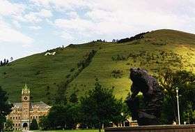
| P, with "14" Inside | Livingston | Park High School | 45°40′17″N 110°33′45″W / 45.6714°N 110.5624°W / 45.6714; -110.5624 (Park High School) |
| h | Plains | | 47°27′43″N 114°52′19″W / 47.4619°N 114.872°W / 47.4619; -114.872 (Plains) |
| h | Polson | | 47°40′47″N 114°08′50″W / 47.6798°N 114.1471°W / 47.6798; -114.1471 (Polson) |
| h | Deer Lodge | Powell County High School | 46°25′20″N 112°45′36″W / 46.4222°N 112.7599°W / 46.4222; -112.7599 (Powell High School) |
| h | Red Lodge | | 45°10′36″N 109°14′33″W / 45.1766°N 109.2425°W / 45.1766; -109.2425 (Red Lodge) |
| h | Reed Point | | 45°42′09″N 109°32′33″W / 45.7026°N 109.5424°W / 45.7026; -109.5424 (Reed Point) |
| h | Roberts | | 45°22′35″N 109°11′11″W / 45.3764°N 109.1864°W / 45.3764; -109.1864 (Roberts) |
| R (no longer exists) | Billings | Rocky Mountain College | 45°48′08″N 108°33′17″W / 45.8023°N 108.5547°W / 45.8023; -108.5547 (Rocky Mountain College) (uncertain location) |
| h | Rosebud | | 46°16′23″N 106°26′14″W / 46.273°N 106.4372°W / 46.273; -106.4372 (Rosebud) |
| h (uncertain existence) | Roundup | | 46°26′17″N 108°32′15″W / 46.4381°N 108.5376°W / 46.4381; -108.5376 (Roundup) (uncertain location) |
| h | Roy | | 47°19′22″N 108°57′10″W / 47.3227°N 108.9527°W / 47.3227; -108.9527 (Roy) |
| h | Ryegate | | 46°18′08″N 109°15′24″W / 46.3023°N 109.2568°W / 46.3023; -109.2568 (Ryegate) |
| S (no longer exists) | Missoula | Sentinel High School | 46°50′49″N 114°00′36″W / 46.847°N 114.0099°W / 46.847; -114.0099 (Sentinel High School) ' |
| h | Shelby | | 48°31′10″N 111°52′02″W / 48.5195°N 111.8671°W / 48.5195; -111.8671 (Shelby) |
| h | Sheridan | Sheridan K-12 Schools | 45°27′05″N 112°07′30″W / 45.4514°N 112.1251°W / 45.4514; -112.1251 (Sheridan) |
| h (uncertain existence) | Saint Regis | | 47°18′23″N 115°06′19″W / 47.3064°N 115.1053°W / 47.3064; -115.1053 (St. Regis) (uncertain location) |
| h | Stanford | | 47°09′56″N 110°16′21″W / 47.1655°N 110.2724°W / 47.1655; -110.2724 (Stanford) |
| h | Superior | | 47°11′44″N 114°52′45″W / 47.1955°N 114.8791°W / 47.1955; -114.8791 (Superior) |
| h | Terry | | 46°48′38″N 105°18′55″W / 46.81058°N 105.3153°W / 46.81058; -105.3153 (Terry) |
| h | Three Forks | | 45°53′11″N 111°39′00″W / 45.8864°N 111.6501°W / 45.8864; -111.6501 (Three Forks) |
| h | Twin Bridges | | 45°33′55″N 112°18′46″W / 45.5653°N 112.3127°W / 45.5653; -112.3127 (Twin Bridges) |
| h | Ulm | | 47°26′19″N 111°30′00″W / 47.4387°N 111.4999°W / 47.4387; -111.4999 (Ulm) |
| h | Victor | | 46°26′23″N 114°11′57″W / 46.4396°N 114.1992°W / 46.4396; -114.1992 (Victor) |
| h | Whitehall | | 45°54′37″N 112°02′14″W / 45.910345°N 112.037352°W / 45.910345; -112.037352 (Whitehall) |
| h (uncertain existence) | Wibaux | | 46°59′16″N 104°11′16″W / 46.9878°N 104.1877°W / 46.9878; -104.1877 (Wibaux) (uncertain location) |
| h | Windham | | 47°05′02″N 110°08′20″W / 47.084°N 110.139°W / 47.084; -110.139 (Windham) |
| h | Winifred | | 47°33′54″N 109°22′07″W / 47.5651°N 109.3685°W / 47.5651; -109.3685 (Winifred) |
| h | Winnett | | 46°59′31″N 108°20′45″W / 46.992°N 108.3458°W / 46.992; -108.3458 (Winnett) |