List
The following table lists the city or town name, the geographic coordinates, the population at the 1990 census, an estimate of the population in 2009, and the island name.
| City/Town |
Coordinates |
Pop. 1990 (census) |
Pop. 2009 (est.) [1] |
Island |
|---|
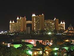
| Nassau |
25°03′36″N 77°20′42″W / 25.06°N 77.345°W / 25.06; -77.345 (Nassau) |
172,196 |
238,132 |
New Providence |
| Freeport |
26°32′N 78°38′W / 26.54°N 78.64°W / 26.54; -78.64 (Freeport) |
35,650 |
47,085 |
Grand Bahama |
| West End |
26°41′N 78°58′W / 26.69°N 78.97°W / 26.69; -78.97 (West End) |
10,535 |
13,004 |
Grand Bahama
|
| Coopers Town |
26°52′N 77°31′W / 26.87°N 77.52°W / 26.87; -77.52 (Coopers Town) |
5,700 |
9,069 |
Abaco |
| Marsh Harbour |
26°33′N 77°03′W / 26.55°N 77.05°W / 26.55; -77.05 (Marsh Harbour) |
3,600 |
5,728 |
Abaco |
| Freetown |
24°46′N 76°16′W / 24.77°N 76.27°W / 24.77; -76.27 (Freetown) |
3,210 |
4,222 |
Eleuthera |
| Bahamas City |
26°38′N 78°17′W / 26.63°N 78.28°W / 26.63; -78.28 (High Rock) |
500 |
3,827 |
Grand Bahama |
| Andros Town |
24°42′N 77°46′W / 24.70°N 77.77°W / 24.70; -77.77 (High Rock) |
2,730 |
2,318 |
Andros |
| Clarence Town |
23°06′N 74°59′W / 23.10°N 74.98°W / 23.10; -74.98 (Clarence Town) |
1,740 |
1,705 |
Long Island |
| Dunmore Town |
25°30′N 76°38′W / 25.50°N 76.63°W / 25.50; -76.63 (Dunmore Town) |
1,200 |
1,578 |
Eleuthera |
| Rock Sound |
24°54′N 76°12′W / 24.90°N 76.20°W / 24.90; -76.20 (Rock Sound) |
1,100 |
1,447 |
Eleuthera |
| Arthur's Town |
24°40′N 75°44′W / 24.66°N 75.73°W / 24.66; -75.73 (Arthur's Town) |
1,350 |
1,216 |
Cat Island |
| Cockburn Town |
24°02′N 74°31′W / 24.03°N 74.52°W / 24.03; -74.52 (Arthur's Town) |
300 |
1,045 |
San Salvador |
| George Town |
23°31′N 75°47′W / 23.52°N 75.78°W / 23.52; -75.78 (George Town) |
1,080 |
1,038 |
Exuma and Cays |
| Alice Town |
25°44′N 79°18′W / 25.74°N 79.30°W / 25.74; -79.30 (Alice Town) |
900 |
936 |
Biminis |
| Sweeting Cay |
26°36′N 77°53′W / 26.60°N 77.88°W / 26.60; -77.88 (Sweeting Cay) |
400 |
494 |
Grand Bahama |
| Matthew Town |
20°58′N 73°41′W / 20.96°N 73.68°W / 20.96; -73.68 (Matthew Town) |
470 |
435 |
Inagua Islands |
| Snug Corner |
22°34′N 73°53′W / 22.56°N 73.88°W / 22.56; -73.88 (Snug Corner) |
380 |
402 |
Acklins Island |
| Great Harbour Cay |
25°46′N 77°51′W / 25.76°N 77.85°W / 25.76; -77.85 (Great Harbour) |
320 |
383 |
Berry Islands |
| Nicholls Town |
25°08′N 78°01′W / 25.14°N 78.01°W / 25.14; -78.01 (Nicholls Town) |
n/a |
255 |
Andros |
| Colonel Hill |
22°46′N 74°13′W / 22.77°N 74.22°W / 22.77; -74.22 (Colonel Hill) |
290 |
224 |
Crooked Island |
| Pirates Well |
22°26′N 73°05′W / 22.43°N 73.08°W / 22.43; -73.08 (Pirates Well) |
270 |
201 |
Mayaguana |
| Port Nelson |
23°40′N 74°50′W / 23.66°N 74.83°W / 23.66; -74.83 (Port Nelson) |
50 |
103 |
Rum Cay |
| Duncan Town |
22°11′N 75°44′W / 22.19°N 75.73°W / 22.19; -75.73 (Duncan Town) |
89 |
63 |
Ragged Island |
| Albert Town |
22°36′N 74°21′W / 22.60°N 74.35°W / 22.60; -74.35 (Albert Town) |
30 |
23 |
Crooked Island |
External links
 Media related to Cities in the Bahamas at Wikimedia Commons
|
|---|
| Sovereign states | |
|---|
Dependencies and
other territories | |
|---|