List of African-American historic places in West Virginia
This is intended to be a complete list of the African American historic places in West Virginia. The locations and districts for which the latitude and longitude coordinates are included below, may be seen in a Google map.[1]
| Color | Denotes |
|---|---|
| NRHP listing | National Register of Historic Places listing |
| NRHP HD | National Register Historic District |
| Not listed on the NRHP | Not listed on the National Register |
| Berkeley - Cabell - Fayette - Hampshire - Harrison - Jefferson - Kanawha - Lewis - McDowell - Mercer - Monongalia - Wood |
Berkeley County
| [2] | Name on the Register | Image | Date listed[3] | Location | City or town | Description |
|---|---|---|---|---|---|---|
| 1 | Mt. Pleasant School |  |
September 18, 2008 (#08000928) |
Abiding Way 39°21′49″N 78°07′28″W / 39.363611°N 78.124444°W |
Gerrardstown |
Cabell County
| [2] | Name on the Register | Image | Date listed[3] | Location | City or town | Description |
|---|---|---|---|---|---|---|
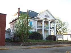
| 1 | Barnett Hospital and Nursing School | 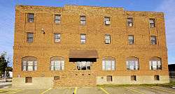 |
December 30, 2009 (#09001190) |
1201 7th Ave. 38°25′03″N 82°26′15″W / 38.417617°N 82.437514°W |
Huntington | |
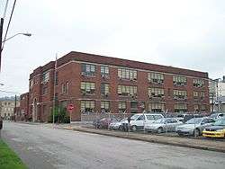
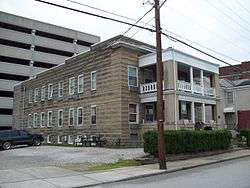
| 2 | Douglass Junior and Senior High School | 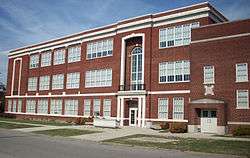 |
December 5, 1985 (#85003091) |
10th Ave. and Bruce St. 38°24′52″N 82°25′53″W / 38.414444°N 82.431389°W |
Huntington | |
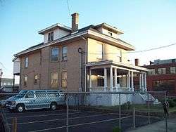
| 3 | West Virginia Colored Children's Home | 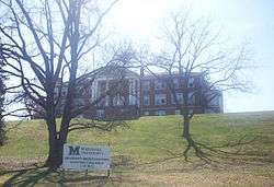 |
November 13, 1997 (#97001413) |
3353 U.S. Route 60 38°24′34″N 82°22′25″W / 38.409444°N 82.373611°W |
Huntington | Demolished on May 5, 2011 to make room for a new middle school.[4][5] |
Fayette County
| [2] | Name on the Register | Image | Date listed[3] | Location | City or town | Description |
|---|---|---|---|---|---|---|
| 1 | Camp Washington-Carver Complex | June 20, 1980 (#80004017) |
County Route 11/3 38°00′36″N 80°58′14″W / 38.01°N 80.970556°W |
Clifftop |
Hampshire County
| [2] | Name on the Register | Image | Date listed[3] | Location | City or town | Description |
|---|---|---|---|---|---|---|
| 1 | Mount Pisgah Benevolence Cemetery | Not listed (#unlisted) |
Along U.S. Route 50 39°20′30″N 78°46′04″W / 39.3417°N 78.7678°W |
Romney | ||
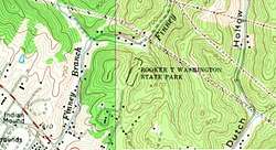
| 2 | Washington Place | 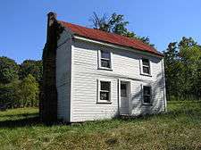 |
Not listed (#unlisted) |
Along West Virginia Route 28 39°21′14″N 78°45′09″W / 39.354003°N 78.752489°W |
Romney |
Harrison County
| [2] | Name on the Register | Image | Date listed[3] | Location | City or town | Description |
|---|---|---|---|---|---|---|
| 1 | Kelly Miller High School | Not listed (#unlisted) |
E. B. Saunders Way 39°16′36″N 80°20′09″W / 39.27675°N 80.33589°W |
Clarksburg |
Jefferson County
| [2] | Name on the Register | Image | Date listed[3] | Location | City or town | Description |
|---|---|---|---|---|---|---|
| 1 | Halltown Colored Free School | 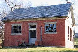 |
August 25, 2004 (#04000912) |
Halltown Rd., 0.5 mi (0.80 km) northeast of U.S. Route 340 39°18′44″N 77°48′06″W / 39.312222°N 77.801667°W |
Halltown | |
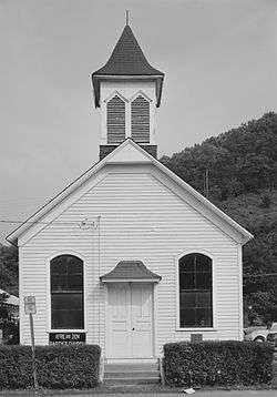
| 2 | Halltown Union Colored Sunday School | 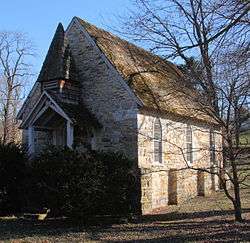 |
January 12, 1984 (#84003591) |
Off U.S. Route 340 39°18′34″N 77°48′11″W / 39.309444°N 77.803056°W |
Halltown | |
| 3 | Storer College | 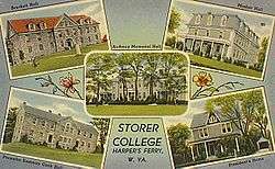 |
October 15, 1966 (#66000041) |
Contributing property to Harpers Ferry National Historical Park NRHP listing 39°19′26″N 77°44′07″W / 39.323789°N 77.735414°W |
Harpers Ferry |
Kanawha County
Lewis County
| [2] | Name on the Register | Image | Date listed[3] | Location | City or town | Description |
|---|---|---|---|---|---|---|
| 1 | Weston Colored School | 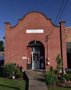 |
April 9, 1993 (#93000224) |
345 Center St. 39°02′23″N 80°27′53″W / 39.039722°N 80.464722°W |
Weston |
McDowell County
| [2] | Name on the Register | Image | Date listed[3] | Location | City or town | Description |
|---|---|---|---|---|---|---|
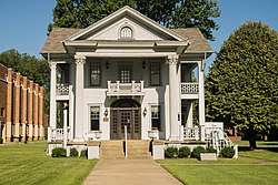
| 1 | World War Memorial | 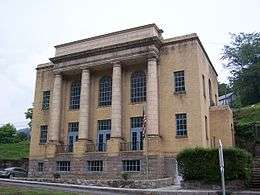 |
April 9, 1993 (#93000227) |
U.S. Route 52 37°25′31″N 81°30′24″W / 37.425278°N 81.506667°W |
Kimball |
Mercer County
| [2] | Name on the Register | Image | Date listed[3] | Location | City or town | Description |
|---|---|---|---|---|---|---|
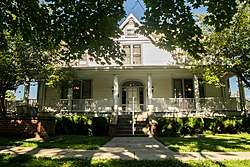
| 1 | Hancock House | January 17, 1990 (#89001783) |
300 Sussex St. 37°16′33″N 81°13′13″W / 37.275833°N 81.220278°W |
Bluefield |
Monongalia County
| [2] | Name on the Register | Image | Date listed[3] | Location | City or town | Description |
|---|---|---|---|---|---|---|
| 1 | Second Ward Negro Elementary School | 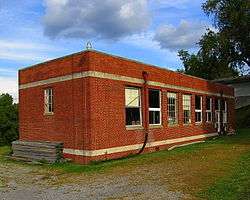 |
July 28, 1992 (#92000896) |
Junction of White and Posten Aves. 39°37′17″N 79°56′57″W / 39.621389°N 79.949167°W |
Morgantown |
Wood County
| [2] | Name on the Register | Image | Date listed[3] | Location | City or town | Description |
|---|---|---|---|---|---|---|
| 1 | Bethel AME Church |  |
October 8, 1998 (#82001767) |
820 Clay St. 39°15′58″N 81°33′18″W / 39.266111°N 81.555°W |
Parkersburg | Demolished |
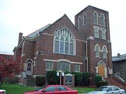
| 2 | Henry Logan Memorial AME Church | 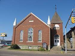 |
December 16, 1982 (#82001778) |
Ann and 6th Sts. 39°16′05″N 81°33′41″W / 39.268056°N 81.561389°W |
Parkersburg |
See also
References
- ↑ The latitude and longitude information provided in this table was derived originally from the National Register Information System, which has been found to be fairly accurate for about 99% of listings. For about 1% of NRIS original coordinates, experience has shown that one or both coordinates are typos or otherwise extremely far off; some corrections may have been made. A more subtle problem causes many locations to be off by up to 150 yards, depending on location in the country: most NRIS coordinates were derived from tracing out latitude and longitudes from USGS topographical quadrant maps created under the North American Datum of 1927, which differs from the current, highly accurate WGS84 GPS system used by most on-line maps. Chicago is about right, but NRIS longitudes in Washington are higher by about 4.5 seconds, and are lower by about 2.0 seconds in Maine. Latitudes differ by about 1.0 second in Florida. Some locations in this table may have been corrected to current GPS standards.
- 1 2 3 4 5 6 7 8 9 10 11 12 Numbers represent an ordering by significant words. Various colorings, defined here, differentiate National Historic Landmarks and historic districts from other NRHP buildings, structures, sites or objects.
- 1 2 3 4 5 6 7 8 9 10 11 12 The eight-digit number below each date is the number assigned to each location in the National Register Information System database, which can be viewed by clicking the number.
- ↑ http://www.herald-dispatch.com/news/briefs/x1411939090/Cabell-school-officials-ready-to-mitigate-loss-of-old-orphanage
- ↑ Herald-Dispatch.com, Huntongton, WV, May 6, 2011
This article is issued from
Wikipedia.
The text is licensed under Creative Commons - Attribution - Sharealike.
Additional terms may apply for the media files.