Midgarth
| Norse name | Linga Holm from Lyngholm |
|---|---|
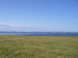 The view north from Linga Holm, towards Sanday | |
| Location | |
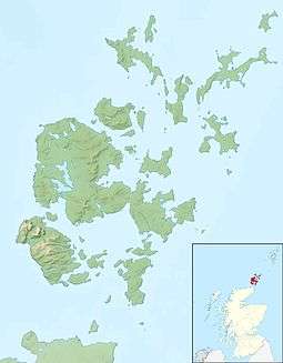 Midgarth Midgarth shown within Orkney | |
| OS grid reference | HY615275 |
| Coordinates | 59°08′N 2°40′W / 59.13°N 2.67°W |
| Physical geography | |
| Island group | Orkney |
| Area | 57 hectares (0.22 sq mi) |
| Area rank | 187 [1] |
| Highest elevation | 10 metres (33 ft) |
| Administration | |
| Sovereign state | United Kingdom |
| Country | Scotland |
| Council area | Orkney Islands |
| Demographics | |
| Population | 0 |
| References | [2][3][4][5] |
Midgarth, also known as the Holm of Midgarth and Linga Holm is an uninhabited Scottish island extending to approximately 57 hectares (0.22 sq mi) situated 700 metres (770 yd) west of Stronsay island in the Orkney archipelago.[6] The name "Linga Holm" is derived from the Old Norse Lyngholm.
History
In common with many other Orkney islands, Midgarth contains numerous archaeological remains. These include Pictish houses and ancient cairns.
Although it is currently uninhabited, a household of six was recorded in 1841.[3][7]
Sheep
In 1973 the Rare Breeds Survival Trust established a refuge population here of the very rare North Ronaldsay sheep, and the flock now numbers some 400.[8][9]
Wildlife
It is thought to be the third largest breeding ground for the Atlantic grey seal in the world, and is an important nesting site for greylag geese.
See also
References
- ↑ Area and population ranks: there are c. 300 islands over 20 ha in extent and 93 permanently inhabited islands were listed in the 2011 census.
- ↑ 2001 UK Census per List of islands of Scotland
- 1 2 Haswell-Smith, Hamish (2004). The Scottish Islands. Edinburgh: Canongate. ISBN 978-1-84195-454-7.
- ↑ Ordnance Survey
- ↑ Anderson, Joseph (Ed.) (1893) Orkneyinga Saga. Translated by Jón A. Hjaltalin & Gilbert Goudie. Edinburgh. James Thin and Mercat Press (1990 reprint). ISBN 0-901824-25-9
- ↑ John Maurius Wilson, The Imperial Gazetteer of Scotland: Or, Dictionary of Scottish Topography, 1854
- ↑ FreeCEN Orkney Website
- ↑ Gazetteer for Scotland: Linga Holm
- ↑ Farmers' Weekly news item about sale of Linga Holm in 1999
External links
- Map sources for Midgarth
| Wikimedia Commons has media related to Linga Holm. |
Coordinates: 59°07′57″N 2°40′28″W / 59.13256°N 2.67444°W