Lemon Grove, Florida
| Lemon Grove, Florida | |
|---|---|
| Census-designated place | |
 Lemon Grove  Lemon Grove | |
| Coordinates: 27°33′30″N 81°40′41″W / 27.55833°N 81.67806°WCoordinates: 27°33′30″N 81°40′41″W / 27.55833°N 81.67806°W | |
| Country | United States |
| State | Florida |
| County | Hardee |
| Area[1] | |
| • Total | 29.845 sq mi (77.30 km2) |
| • Land | 29.836 sq mi (77.27 km2) |
| • Water | 0.009 sq mi (0.02 km2) |
| Elevation | 125 ft (38 m) |
| Population (2010)[1] | |
| • Total | 657 |
| • Density | 22/sq mi (8.5/km2) |
| Time zone | UTC-5 (Eastern (EST)) |
| • Summer (DST) | UTC-4 (EDT) |
| Area code(s) | 863 |
| GNIS feature ID | 294832[2] |
Lemon Grove is an unincorporated community and census-designated place in Hardee County, Florida, United States. Its population was 657 as of the 2010 census.[1] Florida State Road 64 passes through the community.
Geography
Lemon Grove is in northeastern Hardee County, 8 miles (13 km) east of Wauchula, the county seat, and 11 miles (18 km) west of Avon Park.
According to the U.S. Census Bureau, the community has an area of 29.845 square miles (77.30 km2); 29.836 square miles (77.27 km2) of its area is land, and 0.009 square miles (0.023 km2) is water.[1] Charlie Creek, a south-flowing tributary of the Peace River, is the primary water body in the area.
References
- 1 2 3 4 "2010 Census Gazetteer Files - Places: Florida". U.S. Census Bureau. Retrieved March 26, 2017.
- ↑ "Lemon Grove". Geographic Names Information System. United States Geological Survey.
Municipalities and communities of Hardee County, Florida, United States | ||
|---|---|---|
| Cities | 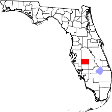 | |
| Town | ||
| CDPs | ||
| Unincorporated communities | ||
| Ghost town | ||
This article is issued from
Wikipedia.
The text is licensed under Creative Commons - Attribution - Sharealike.
Additional terms may apply for the media files.