Lehbach
| Lehbach | |
|---|---|
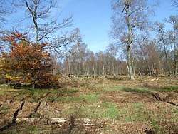 Raised bog at Ellersbach | |
| Location | Rhineland-Palatinate, Germany |
| Reference no. | DE: 26562 |
| Physical characteristics | |
| Main source |
In the Osburger Hochwald at the foot of the Rösterkopf ca. 640 m above sea level (NN) 49°40′00″N 6°48′56″E / 49.6666917°N 6.8154556°E |
| River mouth |
Near Niederkell into the Ruwer ca. 426 m above sea level (NN) 49°37′14″N 6°47′11″E / 49.6204944°N 6.7864500°ECoordinates: 49°37′14″N 6°47′11″E / 49.6204944°N 6.7864500°E |
| Length | 6.6 km [1] |
| Basin features | |
| Progression | Ruwer→ Moselle→ Rhine→ North Sea |
| Basin size | 12.794 km² [1] |
The Lehbach, in its upper reaches also called the Spalbach, is a right-hand tributary of the River Ruwer in the county of Trier-Saarburg in the German state of Rhineland-Palatinate. It has a length of 6.602 kilometres, a catchment area of 12.794 square kilometres and the federal stream index number, 26562.
It rises in the highlands of the Osburger Hochwald at the foot of the Rösterkopf mountain and, together with the 3.205-kilometre-long Ellersbach (also Kreidbach), in whose source region is a raised bog, impounded to form the Keller Reservoir.
The Lehbach lies within the nature reserve of Keller Mulde and discharges near Niederkell into the Ruwer.
References
External links
This article is issued from
Wikipedia.
The text is licensed under Creative Commons - Attribution - Sharealike.
Additional terms may apply for the media files.