Le Roy Township, Bremer County, Iowa
| Le Roy Township, Bremer County | |
|---|---|
| Township | |
 | |
| Coordinates: 42°51′51″N 092°13′18″W / 42.86417°N 92.22167°WCoordinates: 42°51′51″N 092°13′18″W / 42.86417°N 92.22167°W | |
| Country |
|
| State |
|
| County | Bremer |
| Area | |
| • Total | 21.61 sq mi (55.97 km2) |
| • Land | 20.93 sq mi (54.22 km2) |
| • Water | 0.68 sq mi (1.76 km2) |
| Elevation[1] | 1,010 ft (308 m) |
| Population (2010) | |
| • Total | 189 |
| • Density | 9.0/sq mi (3.5/km2) |
| Time zone | UTC-6 (Central) |
| • Summer (DST) | UTC-5 (Central) |
| FIPS code | 19-92424[2] |
| GNIS feature ID | 0468207 |
Le Roy Township is one of fourteen townships in Bremer County, Iowa, USA. At the 2010 census, its population was 189.[3]
Geography
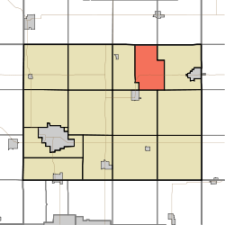
Le Roy Township covers an area of 21.61 square miles (56.0 km2) and contains no incorporated settlements. According to the USGS, it contains five cemeteries: Frederika Township, Le Roy Township, Mentor, Mount Olivet and Pinhook.
References
- ↑ "US Board on Geographic Names". United States Geological Survey. 2007-10-25. Retrieved 2008-01-31.
- ↑ "American FactFinder". United States Census Bureau. Retrieved 2008-01-31.
- ↑ "IA - Le Roy township". United States Census Bureau. Retrieved March 17, 2013.
External links
Municipalities and communities of Bremer County, Iowa, United States | ||
|---|---|---|
| Cities | ||
| Townships | ||
| Unincorporated communities |
| |
| Footnotes | ‡This populated place also has portions in an adjacent county or counties | |
This article is issued from
Wikipedia.
The text is licensed under Creative Commons - Attribution - Sharealike.
Additional terms may apply for the media files.