Le Margnès
| Le Margnès | |
|---|---|
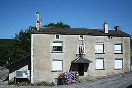 The town hall in Le Margnès | |
 Le Margnès Location within Occitanie region  Le Margnès | |
| Coordinates: 43°38′31″N 2°36′07″E / 43.6419°N 2.6019°ECoordinates: 43°38′31″N 2°36′07″E / 43.6419°N 2.6019°E | |
| Country | France |
| Region | Occitanie |
| Department | Tarn |
| Arrondissement | Castres |
| Canton | Les Hautes Terres d'Oc |
| Intercommunality | Val et Plateau Mont-de-Lacaune |
| Government | |
| • Mayor (2008–2014) | Raymond Gau |
| Area1 | 17.89 km2 (6.91 sq mi) |
| Population (2006)2 | 48 |
| • Density | 2.7/km2 (6.9/sq mi) |
| Time zone | UTC+1 (CET) |
| • Summer (DST) | UTC+2 (CEST) |
| INSEE/Postal code | 81153 /81260 |
| Elevation |
736–1,070 m (2,415–3,510 ft) (avg. 900 m or 3,000 ft) |
|
1 French Land Register data, which excludes lakes, ponds, glaciers > 1 km2 (0.386 sq mi or 247 acres) and river estuaries. 2 Population without double counting: residents of multiple communes (e.g., students and military personnel) only counted once. | |
Le Margnès is a former commune in the Tarn department in southern France. On 1 January 2016, it was merged into the new commune of Fontrieu.[1]
See also
References
- ↑ Arrêté préfectoral 18 November 2015
| Wikimedia Commons has media related to Le Margnès. |
This article is issued from
Wikipedia.
The text is licensed under Creative Commons - Attribution - Sharealike.
Additional terms may apply for the media files.