Laze, Novo Mesto
| Laze | |
|---|---|
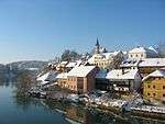
 Laze Location in Slovenia | |
| Coordinates: 45°42′3.6″N 15°8′8.14″E / 45.701000°N 15.1355944°ECoordinates: 45°42′3.6″N 15°8′8.14″E / 45.701000°N 15.1355944°E | |
| Country |
|
| Traditional region | Lower Carniola |
| Statistical region | Southeast Slovenia |
| Municipality | Novo Mesto |
| Area | |
| • Total | 11.44 km2 (4.42 sq mi) |
| Elevation | 337.3 m (1,106.6 ft) |
| Population (2002) | |
| • Total | 65 |
| [1] | |
Laze (pronounced [ˈlaːzɛ]; German: Reuter,[2] also Reuther or Laase[3][4]) is a settlement south of Novo Mesto in southeastern Slovenia. The railway line from Ljubljana to Metlika runs through the settlement. The area is part of the traditional region of Lower Carniola and is now included in the Southeast Slovenia Statistical Region.[5]
The local church, built on the southern outskirts of the village, is dedicated to Saint Matthias and belongs to the Parish of Toplice. It dates to the late 17th century.[6]
References
- ↑ Statistical Office of the Republic of Slovenia
- ↑ Ferenc, Mitja. 2007. Nekdanji nemški jezikovni otok na kočevskem. Kočevje: Pokrajinski muzej, p. 4.
- ↑ Leksikon občin kraljestev in dežel zastopanih v državnem zboru, vol. 6: Kranjsko. 1906. Vienna: C. Kr. Dvorna in Državna Tiskarna, p. 152.
- ↑ Petschauer, Erich. 1980. "Die Gottscheer Siedlungen – Ortsnamenverzeichnis." In Das Jahrhundertbuch der Gottscheer (pp. 181–197). Klagenfurt: Leustik.
- ↑ Novo Mesto municipal site Archived 2009-06-09 at the Wayback Machine.
- ↑ Slovenian Ministry of Culture register of national heritage reference number ešd 2578
External links

This article is issued from
Wikipedia.
The text is licensed under Creative Commons - Attribution - Sharealike.
Additional terms may apply for the media files.