Lautertal
| Lautertal | ||
|---|---|---|
| ||
 Lautertal Location of Lautertal within Vogelsbergkreis district 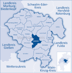 | ||
| Coordinates: 50°35′N 09°17′E / 50.583°N 9.283°ECoordinates: 50°35′N 09°17′E / 50.583°N 9.283°E | ||
| Country | Germany | |
| State | Hesse | |
| Admin. region | Gießen | |
| District | Vogelsbergkreis | |
| Government | ||
| • Mayor | Heiko Stock | |
| Area | ||
| • Total | 53.61 km2 (20.70 sq mi) | |
| Elevation | 477 m (1,565 ft) | |
| Population (2017-12-31)[1] | ||
| • Total | 2,338 | |
| • Density | 44/km2 (110/sq mi) | |
| Time zone | CET/CEST (UTC+1/+2) | |
| Postal codes | 36369 | |
| Dialling codes | 06643, 06645 Engelrod, 06630 Meiches | |
| Vehicle registration | VB | |
| Website | www.lautertal-vogelsberg.de | |
_COA.svg.png)
Lautertal is a community in the Vogelsbergkreis in Hesse, Germany.
Geography
Location
Lautertal lies from 400 to 700 m above sea level in the High Vogelsberg Nature Park (Naturpark Hoher Vogelsberg).
Neighbouring communities
Lautertal borders in the north on the community of Schwalmtal, in the east on the town of Lauterbach, in the south on the town of Herbstein, and in the west on the town of Ulrichstein and the community of Feldatal.
Constituent communities
The community of Lautertal consists of seven centres:
- Dirlammen
- Eichelhain
- Eichenrod
- Engelrod
- Hörgenau (administrative seat)
- Hopfmannsfeld
- Meiches
Politics
Municipal council
As of municipal elections held on 26 March 2006 the seats are apportioned thus:
References
- ↑ "Bevölkerung der hessischen Gemeinden". Hessisches Statistisches Landesamt (in German). September 2018.
Towns and municipalities in Vogelsberg (district) | ||
|---|---|---|
This article is issued from
Wikipedia.
The text is licensed under Creative Commons - Attribution - Sharealike.
Additional terms may apply for the media files.