Lautertal, Bavaria
| Lautertal | ||
|---|---|---|
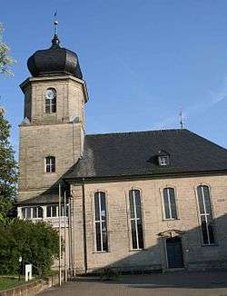 Protestant church | ||
| ||
 Lautertal Location of Lautertal within Coburg district 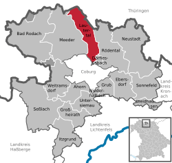 | ||
| Coordinates: 50°20′N 10°58′E / 50.333°N 10.967°ECoordinates: 50°20′N 10°58′E / 50.333°N 10.967°E | ||
| Country | Germany | |
| State | Bavaria | |
| Admin. region | Oberfranken | |
| District | Coburg | |
| Area | ||
| • Total | 30.34 km2 (11.71 sq mi) | |
| Elevation | 300-527 m (−1,429 ft) | |
| Population (2017-12-31)[1] | ||
| • Total | 4,265 | |
| • Density | 140/km2 (360/sq mi) | |
| Time zone | CET/CEST (UTC+1/+2) | |
| Postal codes | 96486 | |
| Dialling codes | 09561, 09566 | |
| Vehicle registration | CO, NEC | |
| Website | www.gemeindelautertal.de | |

Lautertal is a municipality in the district of Coburg in Bavaria in Germany. Near Lautertal, there was between 1952 and 1992 a DECCA-transmitter.
References
- ↑ "Fortschreibung des Bevölkerungsstandes". Bayerisches Landesamt für Statistik und Datenverarbeitung (in German). September 2018.
This article is issued from
Wikipedia.
The text is licensed under Creative Commons - Attribution - Sharealike.
Additional terms may apply for the media files.