Unorganized North East Parry Sound District
| Unorganized North East Parry Sound District | |
|---|---|
| Unorganized area | |
| Parry Sound, Unorganized, North East Part | |
 Unorganized North East Parry Sound Location of Unorganized North East Parry Sound in Ontario | |
| Coordinates: 45°55′N 79°18′W / 45.917°N 79.300°WCoordinates: 45°55′N 79°18′W / 45.917°N 79.300°W[1] | |
| Country |
|
| Province |
|
| District | Parry Sound |
| Area[2] | |
| • Total | 183.27 km2 (70.76 sq mi) |
| Population (2016)[2] | |
| • Total | 187 |
| • Density | 1.0/km2 (2.6/sq mi) |
| Time zone | UTC-5 (Eastern Time Zone) |
| • Summer (DST) | UTC-4 (Eastern Time Zone) |
Unorganized North East Parry Sound District is an unorganized area in Parry Sound District in Central Ontario, Canada.[1][3] It is served by the local services board of Laurier[4] and is part of the Almaguin Highlands region.[5] The region had a population of 187 in the Canada 2016 Census, and a land area of 183.27 square kilometres.[2]
Etymology
The geographic township of Laurier in Parry Sound District was named in 1878 for Wilfrid (later Sir Wilfrid) Laurier (1841-1919), then minister of inland revenue in Alexander Mackenzie's government and later Prime Minister of Canada, 1896-1911.[6]
Transportation
The Canadian National Railway transcontinental main line and Ontario Highway 11 travel a roughly parallel course from the middle of the western edge to the centre of the northern edge of the township.
References
- 1 2 "Laurier". Geographical Names Data Base. Natural Resources Canada. Retrieved 2013-02-25.
- 1 2 3 "2011 Census Profile".
- ↑ "Laurier" (PDF). Geology Ontario - Historic Claim Maps. Ontario Ministry of Northern Development, Mines and Forestry. Retrieved 2013-03-04.
- ↑ Local Services Boards, R.R.O. 1990, Reg. 737. Canadian Legal Information Institute.
- ↑ GeoSearch 2006
- ↑ Rayburn, Alan (1997). Place Names of Ontario. Toronto: University of Toronto Press. p. 190. ISBN 0-8020-7207-0. OCLC 36342881.
Other map sources:
- Map 8 (PDF) (Map). 1 : 700,000. Official road map of Ontario. Ministry of Transportation of Ontario. 2012-01-01. Retrieved 2013-03-04.
- Restructured municipalities - Ontario map #4 (Map). Restructuring Maps of Ontario. Ontario Ministry of Municipal Affairs and Housing. 2006. Retrieved 2013-03-04.
External links
- Almaguin Highlands Communities, Almaguin Highlands Regional Portal
Places adjacent to Unorganized North East Parry Sound District | ||||||||||
|---|---|---|---|---|---|---|---|---|---|---|
| ||||||||||
| Towns | 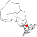 | |
|---|---|---|
| Townships | ||
| Villages | ||
| First Nations | ||
| Indian reserves | ||
| Local services boards | ||
| Unorganized areas | ||
| ||