Lauenförde
| Lauenförde | ||
|---|---|---|
| ||
 Lauenförde Location of Lauenförde within Holzminden district 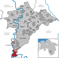  | ||
| Coordinates: 51°39′38″N 9°23′16″E / 51.66056°N 9.38778°ECoordinates: 51°39′38″N 9°23′16″E / 51.66056°N 9.38778°E | ||
| Country | Germany | |
| State | Lower Saxony | |
| District | Holzminden | |
| Municipal assoc. | Boffzen | |
| Government | ||
| • Mayor | Werner Tyrasa (SPD) | |
| Area | ||
| • Total | 17 km2 (7 sq mi) | |
| Elevation | 105 m (344 ft) | |
| Population (2017-12-31)[1] | ||
| • Total | 2,416 | |
| • Density | 140/km2 (370/sq mi) | |
| Time zone | CET/CEST (UTC+1/+2) | |
| Postal codes | 37697 | |
| Dialling codes | 05273 | |
| Vehicle registration | HOL | |

Lauenförde is a municipality in the district of Holzminden, in Lower Saxony, Germany.
Coat of arms
The arms were granted in 1927 and based on a seal of the Amt Lauenförde from 1779. The lion is the so-called Welfen-lion, indicating that the town belonged to this family. The waves symbolise the Weser. Lauenförde is situated on the Weser and used to be one of the major crossing points of this river. It has also been stated that the arms are canting, derived from Löwenfurt (Lion-ford).
Towns and municipalities in Holzminden (district) | ||
|---|---|---|
References
| Authority control |
|---|
This article is issued from
Wikipedia.
The text is licensed under Creative Commons - Attribution - Sharealike.
Additional terms may apply for the media files.