Kirchbrak
| Kirchbrak | |
|---|---|
 Kirchbrak Location of Kirchbrak within Holzminden district 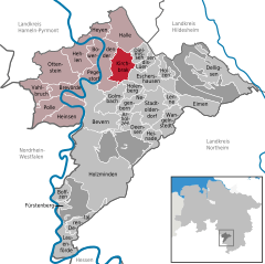  | |
| Coordinates: 51°58′N 9°35′E / 51.967°N 9.583°ECoordinates: 51°58′N 9°35′E / 51.967°N 9.583°E | |
| Country | Germany |
| State | Lower Saxony |
| District | Holzminden |
| Municipal assoc. | Bodenwerder-Polle |
| Government | |
| • Mayor | Wilhelm Brennecke |
| Area | |
| • Total | 18.39 km2 (7.10 sq mi) |
| Elevation | 299-460 m (−1,210 ft) |
| Population (2017-12-31)[1] | |
| • Total | 994 |
| • Density | 54/km2 (140/sq mi) |
| Time zone | CET/CEST (UTC+1/+2) |
| Postal codes | 37619 |
| Dialling codes | 05533 |
| Vehicle registration | HOL |
| Website | www.kirchbrak.de |
Kirchbrak is a municipality in the district of Holzminden, in Lower Saxony, Germany.
Towns and municipalities in Holzminden (district) | ||
|---|---|---|
References
This article is issued from
Wikipedia.
The text is licensed under Creative Commons - Attribution - Sharealike.
Additional terms may apply for the media files.