Las Mercedes Municipality
| Las Mercedes Municipality Municipio Las Mercedes | ||
|---|---|---|
| Municipality | ||
| ||
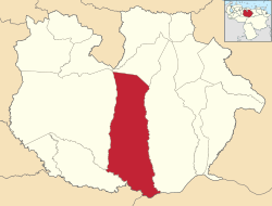 Location in Guárico | ||
.svg.png) Las Mercedes Municipality Location in Venezuela | ||
| Coordinates: 9°06′07″N 66°24′00″W / 9.10193°N 66.39995°WCoordinates: 9°06′07″N 66°24′00″W / 9.10193°N 66.39995°W | ||
| Country |
| |
| State | Guárico | |
| Municipal seat | Las Mercedes del Llano | |
| Area | ||
| • Total | 7,691 km2 (2,970 sq mi) | |
| Population (2010) | ||
| • Total | 31,825 | |
| • Density | 4.1/km2 (11/sq mi) | |
| Time zone | UTC−04:00 (VET) | |
| Area code(s) | 0238 | |
| Website | Official website | |

The Las Mercedes Municipality is one of the 15 municipalities (municipios) that makes up the central Venezuelan state of Guárico and, according to a 2010 population estimate by the National Institute of Statistics of Venezuela, the municipality has a population of 31,825.[1]
Overview
The town of Las Mercedes del Llano is the shire town of the Las Mercedes Municipality.[2]
The Municipality includes the 4.8 km Third Orinoco River Crossing, between Cabruta and Caicara del Orinoco in Bolívar.
See also
References
External links
- lasmercedes-guarico.gob.ve (in Spanish)
This article is issued from
Wikipedia.
The text is licensed under Creative Commons - Attribution - Sharealike.
Additional terms may apply for the media files.