Langli, Changsha
| Langli Subdistrict 㮾梨街道 | |
|---|---|
| Subdistrict | |
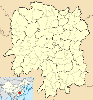
 Langli Subdistrict Location in Hunan | |
| Coordinates: 28°10′38″N 113°07′08″E / 28.1772°N 113.1189°ECoordinates: 28°10′38″N 113°07′08″E / 28.1772°N 113.1189°E | |
| Country | China |
| Province | Hunan |
| Prefecture-level city | Changsha |
| County | Changsha |
| Area | |
| • Total | 40 km2 (20 sq mi) |
| Population (2000) | |
| • Total | 30,279 |
| • Density | 760/km2 (2,000/sq mi) |
| Time zone | UTC+8 (China Standard) |
Langli Subdistrict (Chinese: 㮾梨街道; pinyin: Lǎnɡlí jiēdào, or Chinese: 榔梨街道; pinyin: Lánɡlí jiēdào) is a subdistrict in Changsha County, Changsha, Hunan province, China. It contains five villages and three communities, with the government in Langli Community. It was a town until 2012.[1]
Religion
Taogong Palace is a Taoist temple in the subdistrict.
References
- ↑ "2012年湖南省行政区划调整公告(1号)-中华人民共和国民政部". hunan.mca.gov.cn (in Chinese). 13 April 2012. Archived from the original on 29 January 2017. Retrieved 29 January 2017.
This article is issued from
Wikipedia.
The text is licensed under Creative Commons - Attribution - Sharealike.
Additional terms may apply for the media files.
