Rotenburg (district)
| Rotenburg | ||
|---|---|---|
| District | ||
| ||
 | ||
| Country |
| |
| State | Lower Saxony | |
| Capital | Rotenburg | |
| Area | ||
| • Total | 2,070 km2 (800 sq mi) | |
| Population (31 December 2017)[1] | ||
| • Total | 163,377 | |
| • Density | 79/km2 (200/sq mi) | |
| Time zone | UTC+01:00 (CET) | |
| • Summer (DST) | UTC+02:00 (CEST) | |
| Vehicle registration | ROW or BRV | |
| Website |
landkreis rotenburgwuemme.de | |

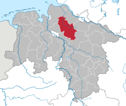
Rotenburg is a district (Landkreis) in Lower Saxony, Germany. It is landlocked by (from the north and clockwise) the districts of Stade, Harburg, Heidekreis, Verden, Osterholz and Cuxhaven.
History
In medieval times the region was part of the bishoprics of Bremen and Verden. After the Protestant Reformation the bishoprics became secular principalities, colloquially called Bremen-Verden, and finally parts of the Kingdom of Hanover.
The present district was established in 1977 by merging the former districts of Rotenburg and Bremervörde.
Geography
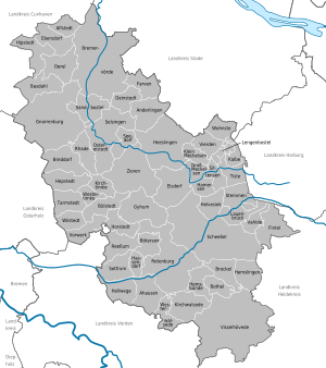
The Wümme River runs through the district from east to west. The marshy area to both sides of the river is called the Wümmeniederung (Wümme Depression).
Coat of arms
The coat of arms displays:
- a lion carrying a cross; the lion was the heraldic animal of Hanover, the cross is symbolising the Prince-Bishopric of Verden
- two criss-crossed keys from the arms of the Prince-Archbishopric of Bremen
Towns and municipalities
| Towns | Samtgemeinden | ||
|---|---|---|---|
|
|
|
|
|
| 1seat of the Samtgemeinde; 2town | |||
References
External links
![]()
- Official website (German)
| Region | |
|---|---|
| Urban districts | |
| Rural districts |
|
Coordinates: 53°15′N 9°20′E / 53.25°N 9.33°E
| Authority control |
|---|