Wümme
| Wümme | |
|---|---|
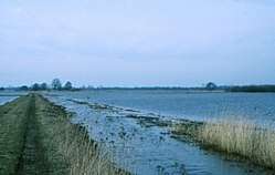 Low riverside pastures of the Wümme near Bremen. During winter these are often flooded. | |
| Country | Germany |
| Physical characteristics | |
| Main source | Lüneburg Heath |
| River mouth |
Lesum 53°10′16″N 8°44′35″E / 53.17111°N 8.74306°ECoordinates: 53°10′16″N 8°44′35″E / 53.17111°N 8.74306°E |
| Length | 121 km (75 mi) |
| Basin features | |
| Progression | Lesum→ Weser→ North Sea |
The Wümme (![]()
It runs 121 kilometres (75 mi) across northern Lower Saxony and the state Free Hanseatic City of Bremen, marking the border between the two states for part of its course.
The river's source is on the Wulfsberg in Lüneburg Heath. West of Rotenburg, it takes up the rivers Rodau and Wiedau. It merges with the Hamme near Wasserhorst (part of Blockland in Bremen), where the two rivers combine forming the Lesum.
Towns on the river Wümme are Lauenbrück, Scheeßel, Rotenburg, Ottersberg, Fischerhude, Lilienthal and Bremen.
References
This article is issued from
Wikipedia.
The text is licensed under Creative Commons - Attribution - Sharealike.
Additional terms may apply for the media files.