Lam Luk Ka District
| Lam Luk Ka ลำลูกกา | |
|---|---|
| Amphoe | |
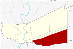 Amphoe location in Pathum Thani Province | |
| Coordinates: 13°55′57″N 100°44′58″E / 13.93250°N 100.74944°ECoordinates: 13°55′57″N 100°44′58″E / 13.93250°N 100.74944°E | |
| Country |
|
| Province | Pathum Thani |
| Seat | Lam Luk Ka |
| Tambon | 8 |
| Area | |
| • Total | 297.71 km2 (114.95 sq mi) |
| Population (2017) | |
| • Total | 273,438 |
| • Density | 918.47/km2 (2,378.8/sq mi) |
| Time zone | UTC+7 (THA) |
| Postal code | 12150 |
| Geocode | 1306 |
Lam Luk Ka (Thai: ลำลูกกา, pronounced [lām lûːk kāː]) is a district (amphoe) of Pathum Thani Province, central Thailand.
History
The name Lam Luk Ka originates from a fertile pond in the district named Bueng Lam Luk Ka. When the government created the district Lam Luk Ka in 1904, they cut the word Bueng off. Locals say the name translates to English as "Song of the baby Raven" and many Raven statues adorn buildings and lightposts along the secondary highway through the city.
Geography
The district is located in a part of Thung Luang same as the districts Thanyaburi and Khlong Luang. Khlong Rangsit is the main water resource of the district.
Neighboring districts are (from the north clockwise) Thanyaburi of Pathum Thani, Ongkharak of Nakhon Nayok Province, Bang Nam Priao of Chachoengsao Province, Nong Chok, Khlong Sam Wa, Sai Mai and Don Mueang of Bangkok, and Mueang Pathum Thani.
Administration
The district is subdivided into 8 subdistricts (tambon). There are 3 town municipalities (thesaban mueang) – Khu Khot, Lam Sam Kaeo and Lat Sawai – and 2 subdistrict municipalities (thesaban tambon) – Lam Luk Ka and Lam Sai. There are 6 subdistrict administrative organizations (SAO).
| 1. | Khu Khot | คูคต | |
| 2. | Lat Sawai | ลาดสวาย | |
| 3. | Bueng Kham Phroi | บึงคำพร้อย | |
| 4. | Lam Luk Ka | ลำลูกกา | |
| 5. | Bueng Thong Lang | บึงทองหลาง | |
| 6. | Lam Sai | ลำไทร | |
| 7. | Bueng Kho Hai | บึงคอไห | |
| 8. | Phuet Udom | พืชอุดม |