Lakes of the North, Michigan
| Lakes of the North, Michigan | |
|---|---|
| Census-designated place & Unincorporated community | |
 Lakes of the North | |
| Coordinates: 44°55′48″N 84°53′6″W / 44.93000°N 84.88500°WCoordinates: 44°55′48″N 84°53′6″W / 44.93000°N 84.88500°W | |
| Country | United States |
| State | Michigan |
| County | Antrim County |
| Township | Mancelona Township, Star Township |
| Area | |
| • Total | 16.7 sq mi (43.3 km2) |
| • Land | 16.6 sq mi (42.9 km2) |
| • Water | 0.2 sq mi (0.4 km2) |
| Elevation | 1,289 ft (393 m) |
| Population (2010) | |
| • Total | 925 |
| • Density | 56/sq mi (21.5/km2) |
| Time zone | UTC-5 (Eastern (EST)) |
| • Summer (DST) | UTC-4 (EDT) |
| FIPS code | 26-45070[1] |
| GNIS feature ID | 2583747[2] |
Lakes of the North is a census-designated place (CDP) in Mancelona and Star townships, Antrim County in the U.S. state of Michigan. The population was 925 at the 2010 census.[3]
Geography
The community is located in northern Michigan, occupying the northeast corner of Mancelona Township and the southeast corner of Star Township in Antrim County. Portions of Mackinaw State Forest are included in the CDP. No major highways run through the community.
According to the United States Census Bureau, Lakes of the North has a total area of 16.7 square miles (43.3 km2), of which 16.6 square miles (42.9 km2) is land and 0.15 square miles (0.4 km2), or 0.87%, is water.[3]
References
- ↑ "American FactFinder". United States Census Bureau. Retrieved 2008-01-31.
- ↑ U.S. Geological Survey Geographic Names Information System: Lakes of the North Census Designated Place
- 1 2 "Geographic Identifiers: 2010 Demographic Profile Data (G001): Lakes of the North CDP, Michigan". U.S. Census Bureau, American Factfinder. Retrieved June 10, 2013.
Municipalities and communities of Antrim County, Michigan, United States | ||
|---|---|---|
| Villages | 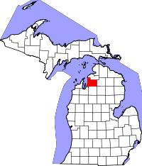 | |
| Townships | ||
| Unincorporated communities | ||
| Indian reservation | ||
| Footnotes | ‡This populated place also has portions in an adjacent county or counties | |
This article is issued from
Wikipedia.
The text is licensed under Creative Commons - Attribution - Sharealike.
Additional terms may apply for the media files.