Lake Mburo National Park
| Lake Mburo National Park | |
|---|---|
|
IUCN category II (national park) | |
 The entrance sign to Lake Mburo National Park | |
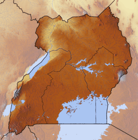 Location of Lake Mburo National Park | |
| Location |
Mbarara District, |
| Nearest city | Mbarara |
| Coordinates | 00°37′40″S 30°58′00″E / 0.62778°S 30.96667°ECoordinates: 00°37′40″S 30°58′00″E / 0.62778°S 30.96667°E |
| Area | 260 square kilometres (100 sq mi) |
| Governing body | Ugandan Wildlife Authority |
| Official name | Lake Mburo-Nakivali Wetland System |
| Designated | 15 September 2006 |
| Reference no. | 1634[1] |
Lake Mburo National Park is a national park located in western Uganda.
Location
Lake Mburo National Park is located in Kiruhura District in the Western Region of Uganda. The park is about 30 kilometres (19 mi), by road, east of Mbarara, the largest city in the sub-region. This location is approximately 240 kilometres (150 mi), by road, west of Kampala, Uganda's capital and largest city. The coordinates of the park are 00 36S, 30 57E (Latitude:0.6000; Longitude:30.9500).[2]
Overview
The park has a variety of animals such as zebra, hippopotamus, impala, warthog, common eland, African buffalo, jackal, African leopard, and over three hundred (300) bird species. At 260 square kilometres (100 sq mi), the park is the smallest of Uganda’s savannah national parks. The park has camp grounds and permanent tent facilities for visitors. In 2009, the Uganda Wildlife Authority, which manages the park announced plans to introduce balloon tourism in the park.[3]
Since 2005, the protected area is considered a Lion Conservation Unit.[4]
History
Lake Mburo was originally gazetted in 1933 as a controlled hunting area and upgraded to a game reserve in 1963. The Banyankole Bahima residents continued to graze their cattle in the reserve until it was upgraded to national park status in 1983. The Obote government's upgrade decision was intended, in part, to weaken the Banyankole, who supported anti-Obote rebels. It came at the time of the Operation Bonanza massacre of 300,000 people. As the evicted pastoralists were not compensated for lost grazing land or assisted with resettling, many remained hostile to the upgrade. The rangeland outside the park was subsequently subdivided into small ranges and subsistence farming plots.[5]
In 1985, the second Obote regime fell and the previous residents of Lake Mburo re-occupied the park's land, expelling park staff, destroying infrastructure, and killing wildlife. Less than half of the park's original land area was eventually re-gazetted by the National Resistance Movement government in 1986.[5]
See also
References
- ↑ "Lake Mburo-Nakivali Wetland System". Ramsar Sites Information Service. Retrieved 25 April 2018.
- ↑ Location of Mburo National Park at Google Maps
- ↑ Lake Mburo National Park To Introduce Balloon Tourism
- ↑ IUCN Cat Specialist Group (2006). Conservation Strategy for the Lion Panthera leo in Eastern and Southern Africa. Pretoria, South Africa: IUCN.
- 1 2 Mallarach, Josep-Maria (2008). Protected landscapes and cultural amb [i.e. and] spiritual values. Heidelberg: World Conservation Union. pp. 132–134. ISBN 3925064605.
External links
| Wikivoyage has a travel guide for Lake Mburo National Park. |
- Giraffes will be translocated to Lake Mburo National Park
- Official government site
- Lake Mburo Information Portal
- Lake Mburo National Park Official Website
- Lion escapes from Lake Mburo national park, injures three people before being gunned down
- UWA Translocate 15 Giraffes to Lake Mburo National Park