Lake Kari
| Lake Kari Քարի լիճ | |
|---|---|
 | |
| Location | near Mount Aragats, Armenia |
| Coordinates | 40°28′24.78″N 44°10′51.92″E / 40.4735500°N 44.1810889°ECoordinates: 40°28′24.78″N 44°10′51.92″E / 40.4735500°N 44.1810889°E |
| Basin countries | Armenia |
| Surface area | 0.3 km2 (0.12 sq mi) |
| Water volume | 357,000 m3 (12,600,000 cu ft) |
| Surface elevation | 3,185 m (10,449 ft) |
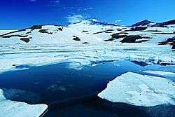
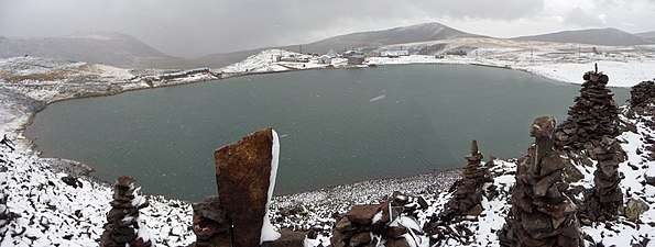
Lake Kari (Lake Qari, Armenian: Քարի լիճ) is a lake in Armenia located in the slopes of Mount Aragats mostly formed by ice and snow. It is located 3,185 m above the sea level and has a perimeter of 1,150 m.[1] From Byurakan village an asphalted automobile road stretches towards the source of Arkashen River, the lake Kari, located on a plateau below the peaks. On the eastern side of the lake there is a meteorological station.
See also
References
- ↑ "Government Cadastre of Armenia" (PDF). p. 133.
ՔԱՐԻ ԼԻՃ - լիճ Արագածոտնի մար- զում, Արագած լեռան հվ. կատարային մասում, ծովի մակարդակից 3185 մ բարձրության վրա: Մակերեսը` 0,3 կմ2:
This article is issued from
Wikipedia.
The text is licensed under Creative Commons - Attribution - Sharealike.
Additional terms may apply for the media files.