Lake Isabella
| Lake Isabella | |
|---|---|
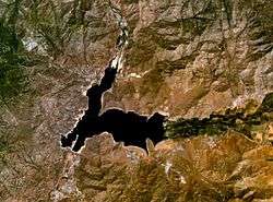 Satellite image of Lake Isabella | |
| Location | Kern County, California, United States |
| Coordinates | 35°40′17.69″N 118°25′38.05″W / 35.6715806°N 118.4272361°WCoordinates: 35°40′17.69″N 118°25′38.05″W / 35.6715806°N 118.4272361°W |
| Lake type | reservoir |
| Primary inflows | Upper Kern River, South Fork Kern River |
| Primary outflows | Lower Kern River |
| Basin countries | United States |
| Surface area | 11,000 acres (4,500 ha) |
| Water volume | 568,000 acre feet (701,000 dam3) |
| Surface elevation | 2,500 ft (760 m) |
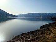
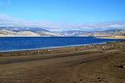
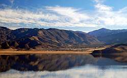
Lake Isabella (also called Isabella Lake )[1][2] is a reservoir in Kern County, California, United States created by the earthen Isabella Dam. It was formed in 1953 when the U.S. Army Corps of Engineers dammed the Kern River at the junction of its two forks at Whiskey Flat. At 11,000 acres (4,500 ha), it is one of the larger reservoirs in California. The area is in the southern end of the Sierra Nevada range and the lake itself is located in low mountains at an elevation of approximately 2,500 ft (760 m) where summer temperatures reach over 100 °F (38 °C) but low enough to avoid winter snows on the surrounding ridges. Lake Isabella is located about 40 miles (64 km) northeast of Bakersfield, and is the main water supply for that city. Lake Isabella can be reached by car from Bakersfield via state Highway 178 and from Delano via Highway 155. The former towns of Isabella and Kernville were flooded by the newly created reservoir.
Isabella Dam deficiency
In 2006, Isabella Dam was found to be too unstable to hold a full amount of water and approximately 40% of a full reservoir had to be let out to restabilize the earth works. Presently the U.S. Army Corps of Engineers won't let the water get above 60% of capacity until an estimated 10–15 years of studies and repairs are made.(completion date needed) To further add to this problem the Isabella Dam bisects an active fault that could lead to a catastrophic failure if an earthquake occurs along it. This fault was considered inactive when the site was studied in the late 1940s.
In September 2018 the US Army Corps of Engineers have started construction to repair the dams at Lake Isabella. They gave the following information:
Highlights (Last 30 days) The Phase II Dams and Spillways contractor (Flatiron/Dragados/Sukut Joint Venture, or FDS) has begun construction activities. USACE has added some signage at/around the entrance to French Gulch to improve traffic circulation. The construction area including Engineers Point is an active construction area and is off limits to the public. FDS continues to coordinate with local labor unions for labor support to the project. The FDS local office is open and they have information about employment opportunities and a telephone information line for job seekers and other inquiries – (833) 640-1010. Looking Ahead (Next 30+ days) USACE is working with Southern California Edison to obtain the Borel Canal easement through the Auxiliary Dam. USACE anticipates decommissioning the Borel Outlet Works in fall 2018. Reservoir pool levels are being lowered in anticipation of beginning Borel construction work in October 2018. The pool elevation will be lowered to 72,000 ac-ft (2543 feet) by October 1. USACE is preparing a plan to extend the French Gulch boat launch during the low water level period. Construction on SR155 will create traffic delays near the Main Dam later this year. USACE expects construction to begin in September and continue into 2019. We will provide updates on expected impacts via public outreach, the monthly SITREP, and the Isabella Task Force. Blasting will commence later this fall between the Main and Auxiliary Dams for the emergency spillway excavation. A public meeting will be scheduled beforehand to provide more information on the schedule and impacts to the public.
The current pool resides at 89,538 acre-feet, and an elevation of 2,544.04 feet, which is 25% of the restricted pool. As part of our interim risk reduction measures, Isabella Lake has a restricted elevation of 2,589 feet (361,250 acre-feet). Current lake status can be viewed at http://1.usa.gov/1enHdTy
Pre-Construction Engineering and Design Complete Construction of USFS Facilities Complete Dams and Spillways Construction 2018-2022
Recreation
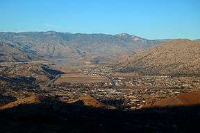
The dam is operated by the U.S. Army Corps of Engineers and several recreation areas are located around the lake as a part of the Sequoia National Forest. The lake is a dividing point. Upper Kern River flows into Lake Isabella, Lower Kern River flows out of the dam and toward Bakersfield. The nearby towns of Lake Isabella and Kernville receive economic benefit from tourism created by the Lake Isabella Recreation Area and the whitewater rafting attraction of the Upper and Lower Kern River. Much of the wilderness surrounding the lake is part of the Sequoia National Forest.
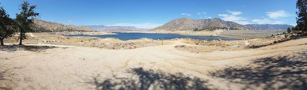
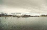
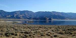
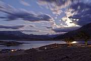
Gallery
See also
External links
References
- ↑ U.S. Geological Survey Geographic Names Information System: Isabella Lake
- ↑ Durham, David L. (2000). Durham's Place Names of Central California: Includes Madera, Fresno, Tulare, Kings & Kern Counties. Quill Driver Books. p. 132. ISBN 978-1-884995-33-0.
- ↑ CURRENT LAKE STATUS (as of September 4, 2018)
| Wikimedia Commons has media related to Lake Isabella, California. |