Lake Auburn
| Lake Auburn | |
|---|---|
 Lake Auburn | |
| Location | Androscoggin County, Maine |
| Coordinates | 44°08′49″N 70°15′00″W / 44.147°N 70.250°WCoordinates: 44°08′49″N 70°15′00″W / 44.147°N 70.250°W |
| Surface area | 2,260 acres (910 ha) |
| Max. depth | 118 feet (36 m) |
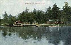
Lake Auburn in 1911

Professor Jonathan Stanton of Bates College on a bird walk in Maine at Lake Auburn
Lake Auburn is a lake and reservoir in Auburn, Maine. The Lake has a total area of 2,260 acres (910 ha) and a maximum depth of 118 feet (36 m).[1] It is the water supply for the Lewiston-Auburn area. The lake is closed to most recreational activity, including ice fishing and swimming.[2] In 2013, the Lake experienced several algal blooms, though the fishing conditions were not harmed by the change in conditions.[3]
References
- ↑ "Auburn Lake" (PDF). Maine. Retrieved 7 February 2018.
- ↑ "LAKE AUBURN WATERSHED PROTECTION COMMISSION" (PDF). LakeAuburnWater.org. Retrieved 5 September 2014.
- ↑ Fleming, Deirdre (May 4, 2013). "Lake Auburn: Good fishing in troubled water". Portland Press Herald. Retrieved 5 September 2014.
This article is issued from
Wikipedia.
The text is licensed under Creative Commons - Attribution - Sharealike.
Additional terms may apply for the media files.