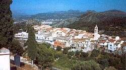
La Vall de Laguar
| La Vall de Laguar | ||
|---|---|---|
| Municipality | ||
 | ||
| ||
 La Vall de Laguar Location of La Vall de Gallinera within Spain / Valencian Community 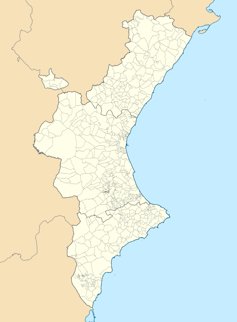 La Vall de Laguar La Vall de Laguar (Valencian Community) La Vall de Laguar La Vall de Laguar (Europe) | ||
| Coordinates: 38°46′37″N 0°06′36″W / 38.77694°N 0.11000°WCoordinates: 38°46′37″N 0°06′36″W / 38.77694°N 0.11000°W | ||
| Country |
| |
| Autonomous Community |
| |
| Province | Alicante | |
| Comarca | Marina Alta | |
| Government | ||
| • Type | Mayor-council government | |
| • Body | Ajuntament de La Vall de Laguar | |
| • Mayor | Francisco Gilavert (PSPV-PSOE) | |
| Area | ||
| • Total | 22.96 km2 (8.86 sq mi) | |
| Elevation | 450 m (1,480 ft) | |
| Population (2012) INE | ||
| • Total | 959 | |
| • Density | 42/km2 (110/sq mi) | |
| Demonym(s) |
Laguartiano, -na (es) guarer, ra (va) vallero, -ra (es) | |
| Time zone | CET (GMT +1) | |
| • Summer (DST) | CEST (GMT +2) | |
| Postcode | 03791 | |

La Vall de Laguar is a chain of three village in the province of Alicante and autonomous community of Valencia, Spain. The villages are, from the lowest and first encountered if entering the Val from the town of Orba, the most usual route, Campell,Fleix and Benimaurell. The municipality covers an area of 22.96 square kilometres (8.86 sq mi) and as of 2011 had a population of 961 people.[1]
References
- ↑ "Alicante/Alacant: Población por municipios y sexo:Cifras oficiales de población resultantes de la revisión del Padrón municipal a 1 de enero de 2011". Spanish Census. Instituto Nacional de Estadística. Archived from the original on 21 May 2012. Retrieved 24 May 2012.
This article is issued from
Wikipedia.
The text is licensed under Creative Commons - Attribution - Sharealike.
Additional terms may apply for the media files.