Lagazuoi
| Lagazuoi | |
|---|---|
 | |
| Highest point | |
| Elevation | 2,835 m (9,301 ft) |
| Prominence | 183 metres (600 ft) |
| Isolation | 1 kilometre (0.62 mi) |
| Coordinates | 46°31′47″N 12°0′11″E / 46.52972°N 12.00306°ECoordinates: 46°31′47″N 12°0′11″E / 46.52972°N 12.00306°E |
| Geography | |
 Lagazuoi Location in the Alps | |
| Location | Province of Belluno, Italy |
| Parent range | Dolomites |
Lagazuoi is a mountain in the Dolomites of northern Italy, lying at an altitude of 2,835 metres (9,301 ft), about 18 kilometres (11 mi) southwest by road from Cortina d'Ampezzo in the Veneto Region. It is accessible by cable car and contains the Rifugio Lagazuoi, a mountain refuge situated beyond the northwest corner of Cima del Lago.[1] The mountain range is well known for its wartime tunnels and First World War mine warfare. The extensive tunnels were built by the Italian troops trying to wrest control from Austro-Hungarian troops who also built tunnels. The tunnels are now open as a de facto museum.[2]
.jpg)
References
- ↑ Price, Gillian. Treks in the Dolomites. Cicerone Press Limited. p. 41. ISBN 978-1-84965-024-3.
- ↑ "Via Ferrata - Protected Climbing Paths in the Dolomites". Andrew Lavigne's web site. Retrieved 2017-05-12.
Comune of Cortina d'Ampezzo | ||
|---|---|---|
| Geography | 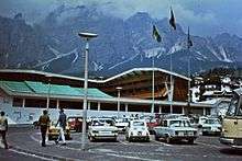 | |
| Architecture | ||
| Sport |
| |
| People |
| |
This article is issued from
Wikipedia.
The text is licensed under Creative Commons - Attribution - Sharealike.
Additional terms may apply for the media files.