Lagarfljót
| Lagarfljót | |
|---|---|
 | |
| Coordinates | 65°11′N 14°36′W / 65.183°N 14.600°WCoordinates: 65°11′N 14°36′W / 65.183°N 14.600°W |
| Primary inflows | Lagarfljót |
| Primary outflows | Lagarfljót |
| Basin countries | Iceland |
| Max. length | 25 km (16 mi) |
| Max. width | 2.5 km (1.6 mi) |
| Surface area | 53 km2 (20 sq mi) |
| Max. depth | 112 m (367 ft) |
| Surface elevation | 20 m (66 ft) |
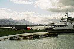
Lagarfljót (also called Lögurinn) is a lake situated in the east of Iceland near Egilsstaðir. Its surface measures 53 square kilometres (20 sq mi) and it is 25 kilometres (16 mi) long; its greatest width is 2.5 km (1.6 mi) and its greatest depth 112 m (367 ft). The River Lagarfljót flows through this lake. The 27 MW Lagarfossvirkjun hydropower station is located at its lower end.[1]
The biggest forest in Iceland, Hallormsstaðaskógur is found near the lake as well as a waterfall, Hengifoss. Hengifoss, at 118 m (387 ft), is one of the tallest waterfalls in the country. Below it is another waterfall called Litlanesfoss.
As with the Scottish lake Loch Ness, a cryptid serpent, called Lagarfljótsormurinn by locals, is believed by some to live in the depths of Lagarfljót.
See also
References
- ↑ "Lagarfossvirkjun". orkusalan.is (in Icelandic). Retrieved 2017-12-04. <! 65.506942, -14.364486 -->
External links