Lac des Arcs (Alberta)
| Lac des Arcs | |
|---|---|
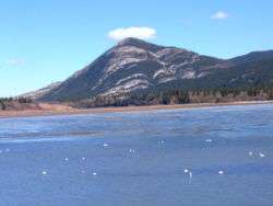 Tundra swans. A few houses of the hamlet can be seen in the trees on the far shore. | |
| Location | Bighorn No. 8, Alberta |
| Coordinates | 51°03′15″N 115°10′47″W / 51.05417°N 115.17972°WCoordinates: 51°03′15″N 115°10′47″W / 51.05417°N 115.17972°W |
| Primary inflows | Bow River |
| Primary outflows | Bow River |
| Basin countries | Canada |
| Surface elevation | 1,320 meters (4,330 ft) |
| Settlements | Lac des Arcs |
Lac des Arcs is a lake in Alberta, Canada that forms part of the Bow River.
Located within Alberta's Rockies, the Hamlet of Lac des Arcs is located on the lake's southeastern shore, while the Lafarge Exshaw Plant and a limestone quarry lie on the lake's northern shore.
The Trans-Canada Highway runs along the southern shore, and a Canadian Pacific Railway line and Highway 1A follow the northern shore. The lake is also locally known for having a small island with nothing but a picnic bench on it, which is visible from the Trans-Canada Highway.

This article is issued from
Wikipedia.
The text is licensed under Creative Commons - Attribution - Sharealike.
Additional terms may apply for the media files.