Lac-Pythonga, Quebec
| Lac-Pythonga | |
|---|---|
| Unorganized territory | |
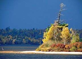 Jean-Peré Lake in La Vérendrye Wildlife Reserve | |
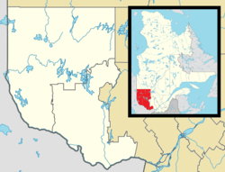 Lac-Pythonga Location in western Quebec. | |
| Coordinates: 46°23′N 76°26′W / 46.383°N 76.433°WCoordinates: 46°23′N 76°26′W / 46.383°N 76.433°W[1] | |
| Country |
|
| Province |
|
| Region | Outaouais |
| RCM | La Vallée-de-la-Gatineau |
| Constituted | January 1, 1986 |
| Government[2] | |
| • Federal riding | Pontiac |
| • Prov. riding | Gatineau |
| Area[2][3] | |
| • Total | 5,934.70 km2 (2,291.40 sq mi) |
| • Land | 5,129.62 km2 (1,980.56 sq mi) |
| Population (2011)[3] | |
| • Total | 0 |
| • Density | 0.0/km2 (0/sq mi) |
| • Pop (2006–11) |
|
| • Dwellings | 15 |
| Time zone | UTC−5 (EST) |
| • Summer (DST) | UTC−4 (EDT) |
Lac-Pythonga is an unorganized territory in the Outaouais region of Quebec, Canada. It surrounds Lake Pythonga and is the largest of the five unorganized territories in the La Vallée-de-la-Gatineau Regional County Municipality.
The Rapid Lake First Nation reserve, located on the western shore of Cabonga Reservoir, is an enclave within this territory.
Demographics
Population trend:
- Population in 2011: 0
- Population in 2006: 0
- Population in 2001: 0
References
- ↑ Reference number 149665 of the Commission de toponymie du Québec (in French)
- 1 2 Ministère des Affaires municipales, des Régions et de l'Occupation du territoire - Répertoire des municipalités: Lac-Pythonga
- 1 2 Statistics Canada 2011 Census - Lac-Pythonga census profile
Places adjacent to Lac-Pythonga, Quebec | |
|---|---|
| Cities | |
|---|---|
| Municipalities | |
| Townships | |
| Unorganized territories | |
| |
This article is issued from
Wikipedia.
The text is licensed under Creative Commons - Attribution - Sharealike.
Additional terms may apply for the media files.