La Torre de Esteban Hambrán
| La Torre de Esteban Hambrán | ||
|---|---|---|
| Municipality | ||
| ||
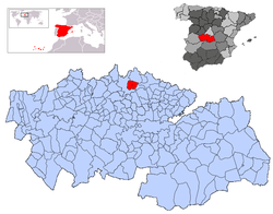 | ||
 La Torre de Esteban Hambrán Location in Spain | ||
| Coordinates: 40°10′7″N 4°13′7″W / 40.16861°N 4.21861°WCoordinates: 40°10′7″N 4°13′7″W / 40.16861°N 4.21861°W | ||
| Country |
| |
| Autonomous community |
| |
| Province | Toledo | |
| Comarca | Torrijos, Spain | |
| Judicial district | Torrijos | |
| Founded | Musulmana | |
| Government | ||
| • Alcalde | Ángel Marinas Alonso (2007) | |
| Area | ||
| • Total | 51 km2 (20 sq mi) | |
| Elevation | 560 m (1,840 ft) | |
| Population (2008) | ||
| • Total | 1,758 | |
| • Density | 34/km2 (89/sq mi) | |
| Demonym(s) | Torreño, ña | |
| Time zone | UTC+1 (CET) | |
| • Summer (DST) | UTC+2 (CEST) | |
| Postal code | 45920 | |
| Website | Official website | |

La Torre de Esteban Hambrán is a Spanish village and municipality in the province of Toledo in Castile-La Mancha. It is adjacent to the municipalities of Santa Cruz del Retamar, Méntrida, Casarrubios del Monte, and Las Ventas de Retamosa.
Origin of name
The village's name, which means "Tower of Esteban Hambrán" in English, may be derived from a 13th-century Muslim tower belonging to a Mozarab named Esteban Ambrán. The tower was used to communicate, by means of fire signals, with the distant Castle of Alamín.
History
The town was founded by the Romans in 171 BC, but little is known about the Roman era of the village. After the Reconquista, the area around the "Esteban Hambrán" tower became populated. In the early 15th century, the land belonged to Pero López de Ayala. The village was bought in 1436 by Álvaro de Luna. When some years later John II of Castile confiscated the place, the village became crown property.
Demography
The population was 1,756 in 2006.
Monuments
- St. Anne's Chapel
- St. Rochus' Chapel
- St. Mary Magdalene's Parish Church
- St. John the Evangelist's Franciscan Convent
- Several fountains
- Funeral Catafalque
External links
- Delegation of Toledo.
- List of mayors: MAP.