Corral de Almaguer
| Corral de Almaguer | |
|---|---|
| Municipality | |
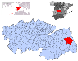 | |
 Corral de Almaguer Location in Spain | |
| Coordinates: 39°45′34″N 3°9′54″W / 39.75944°N 3.16500°WCoordinates: 39°45′34″N 3°9′54″W / 39.75944°N 3.16500°W | |
| Country |
|
| Autonomous community |
|
| Province | Toledo |
| Comarca | La Mancha |
| Judicial district | Quintanar de la Orden |
| Founded | Ver texto |
| Government | |
| • Alcaldesa | Juliana Fernández de la Cueva Lominchar(2007) |
| Area | |
| • Total | 326 km2 (126 sq mi) |
| Elevation | 714 m (2,343 ft) |
| Population (2008) | |
| • Total | 6,194 |
| • Density | 19/km2 (49/sq mi) |
| Demonym(s) | Corraleño, ña |
| Time zone | UTC+1 (CET) |
| • Summer (DST) | UTC+2 (CEST) |
| Postal code | 45880 |
| Dialing code | 925 |
| Website | Official website |
Corral de Almaguer is a Spanish municipality of Toledo province, in the autonomous community of Castile-La Mancha. Its population is 5.549 and its surface is 329 km², with a density of 16.9 people/km².
The mayor of Corral de Almaguer is Juliana Fernández de la Cueva Lominchar of the ruling Partido Popular.
In the 2004 Spanish General Election the Partido Popular got 56.0% of the vote in Corral de Almaguer, the Partido Socialista Obrero got 39.1% and Izquierda Unida got 2.8%.
This article is issued from
Wikipedia.
The text is licensed under Creative Commons - Attribution - Sharealike.
Additional terms may apply for the media files.