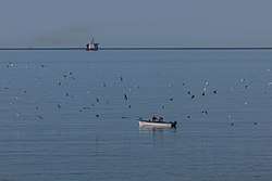
L'Anse-au-Loup
| L'Anse-au-Loup Wolf Cove | |
|---|---|
| Town | |
 | |
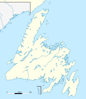 L'Anse-au-Loup Location of L'Anse-au-Loup in Newfoundland | |
| Coordinates: 51°31′33″N 56°50′01″W / 51.5257°N 56.8335°WCoordinates: 51°31′33″N 56°50′01″W / 51.5257°N 56.8335°W | |
| Country | Canada |
| Province | Newfoundland and Labrador |
| Area[1] | |
| • Land | 3.48 km2 (1.34 sq mi) |
| Population (2016)[1] | |
| • Total | 558 |
| • Density | 160.5/km2 (416/sq mi) |
| Time zone | UTC-3:30 (Newfoundland Time) |
| • Summer (DST) | UTC-2:30 (Newfoundland Daylight) |
| Area code(s) | 709 |
| Highways | Route 510 |
L'Anse-au-Loup is a town in the Canadian province of Newfoundland and Labrador. The town had a population of 558 in the Canada 2016 Census, slightly up from 550 in 2011.[1] In the Canada 2006 Census, there were 593 inhabitants.
The town is located along Route 510 in Labrador, between Forteau and L'Anse-au-Diable. The town was incorporated in 1975. The first mayor was Reginald O'Brien Sr.
See also
References
- 1 2 3 "L'Anse au Loup, T [Census subdivision], Newfoundland and Labrador and Canada [Country] (table) Census Profile". 2016 Census. Statistics Canada. Retrieved 27 February 2018.
This article is issued from
Wikipedia.
The text is licensed under Creative Commons - Attribution - Sharealike.
Additional terms may apply for the media files.