Cartwright, Newfoundland and Labrador
| Cartwright Natsitok[1] | |
|---|---|
| Town | |
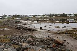 | |
 Cartwright Location of Cartwright in Newfoundland | |
| Coordinates: 53°42′28″N 57°00′58″W / 53.70778°N 57.01611°W | |
| Country |
|
| Province |
|
| Settled | 1775 |
| Incorporated | 1956 |
| Government | |
| • Mayor | Dwight Lethbridge |
| Area | |
| • Land | 3.27 km2 (1.26 sq mi) |
| Elevation | 10 m (30 ft) |
| Population (2016) | |
| • Total | 427[2] |
| Time zone | UTC-4:00 (Atlantic Time) |
| • Summer (DST) | UTC-3:00 (Atlantic Daylight) |
| Area code(s) | 709 |
Cartwright is a community located on the eastern side of the entrance to Sandwich Bay, along the southern coast of Labrador in the province of Newfoundland and Labrador, Canada. It was incorporated in 1956.
Cartwright has been a settled community since 1775. In 1775, Captain George Cartwright, for whom the place is named, settled there, establishing a fish and fur trading business. He left Labrador in 1786, maintaining a business interest there until it was sold to Hunt and Henley in 1815. It was again sold in 1873 to the Hudson's Bay Company and has remained under company ownership ever since.
Since 2002, Cartwright has been connected by road (a section of the Trans-Labrador Highway) with Blanc Sablon, Quebec where there is a car ferry to Newfoundland.[3] Since December 2009 the remaining link between Cartwright and Goose Bay, Labrador has been completed and open to the public.
Demographics
At the 2011 census the population was 516, down 6.5% from 552 in the 2006 census.[2]
Climate
Cartwright has a subarctic climate (Dfc) with very snowy winters and short, mild summers. Owing to its maritime location, the winters are however a little milder than on most of the Labrador Peninsula, but snow depth from the stormy Icelandic Low, which circulates cold and saturated air around the region, is extreme: it averages around 1.6 metres (63 in) at its peak early in March and has reached as high as 3.51 metres (138 in) on April 7, 2003.[4] Snow is usually fully melted early in June and is established again in mid-October.[4] Unlike most of Labrador, there is no permafrost because of the insulation from the deep snow cover, although the annual mean temperature is 0.0 °C (32.0 °F).
| Climate data for Cartwright (1981−2010) | |||||||||||||
|---|---|---|---|---|---|---|---|---|---|---|---|---|---|
| Month | Jan | Feb | Mar | Apr | May | Jun | Jul | Aug | Sep | Oct | Nov | Dec | Year |
| Record high °C (°F) | 11.8 (53.2) |
11.7 (53.1) |
16.4 (61.5) |
18.2 (64.8) |
30.0 (86) |
35.3 (95.5) |
36.1 (97) |
33.0 (91.4) |
30.0 (86) |
23.3 (73.9) |
19.7 (67.5) |
13.3 (55.9) |
36.1 (97) |
| Average high °C (°F) | −9.5 (14.9) |
−8.5 (16.7) |
−3.6 (25.5) |
2.4 (36.3) |
7.7 (45.9) |
13.8 (56.8) |
17.8 (64) |
18.0 (64.4) |
13.3 (55.9) |
6.8 (44.2) |
1.0 (33.8) |
−5.0 (23) |
4.5 (40.1) |
| Daily mean °C (°F) | −14.3 (6.3) |
−13.5 (7.7) |
−8.7 (16.3) |
−1.8 (28.8) |
3.3 (37.9) |
8.6 (47.5) |
12.3 (54.1) |
12.7 (54.9) |
9.0 (48.2) |
3.7 (38.7) |
−2.0 (28.4) |
−8.8 (16.2) |
0.0 (32) |
| Average low °C (°F) | −18.9 (−2) |
−18.5 (−1.3) |
−13.8 (7.2) |
−6.1 (21) |
−1.1 (30) |
3.4 (38.1) |
6.8 (44.2) |
7.4 (45.3) |
4.6 (40.3) |
0.5 (32.9) |
−4.9 (23.2) |
−12.6 (9.3) |
−4.4 (24.1) |
| Record low °C (°F) | −37.8 (−36) |
−34.5 (−30.1) |
−32.2 (−26) |
−25.6 (−14.1) |
−15.0 (5) |
−5.6 (21.9) |
−1.7 (28.9) |
−0.6 (30.9) |
−5.0 (23) |
−11.7 (10.9) |
−21.1 (−6) |
−33.9 (−29) |
−37.8 (−36) |
| Average precipitation mm (inches) | 86.4 (3.402) |
90.7 (3.571) |
92.1 (3.626) |
75.1 (2.957) |
68.2 (2.685) |
98.7 (3.886) |
100.8 (3.969) |
94.1 (3.705) |
89.4 (3.52) |
101.5 (3.996) |
84.7 (3.335) |
92.0 (3.622) |
1,073.5 (42.264) |
| Average rainfall mm (inches) | 5.3 (0.209) |
9.8 (0.386) |
10.5 (0.413) |
21.1 (0.831) |
47.9 (1.886) |
95.0 (3.74) |
100.8 (3.969) |
94.1 (3.705) |
88.8 (3.496) |
88.6 (3.488) |
37.6 (1.48) |
17.6 (0.693) |
616.8 (24.283) |
| Average snowfall cm (inches) | 83.7 (32.95) |
82.2 (32.36) |
80.7 (31.77) |
54.4 (21.42) |
20.5 (8.07) |
3.0 (1.18) |
0.0 (0) |
0.0 (0) |
0.8 (0.31) |
12.7 (5) |
48.0 (18.9) |
76.0 (29.92) |
462.0 (181.89) |
| Average precipitation days (≥ 0.2 mm) | 16.1 | 14.5 | 16.2 | 14.2 | 16.3 | 17.7 | 19.0 | 17.5 | 17.2 | 18.0 | 15.9 | 17.0 | 199.7 |
| Average rainy days (≥ 0.2 mm) | 2.2 | 2.4 | 4.0 | 6.2 | 12.5 | 17.5 | 19.0 | 17.5 | 17.2 | 16.0 | 8.1 | 4.5 | 126.9 |
| Average snowy days (≥ 0.2 cm) | 15.8 | 13.7 | 14.9 | 11.1 | 6.8 | 1.2 | 0.0 | 0.0 | 0.3 | 4.6 | 11.2 | 15.1 | 94.7 |
| Mean monthly sunshine hours | 85.3 | 116.0 | 122.2 | 138.0 | 164.2 | 163.5 | 186.9 | 192.5 | 116.3 | 93.2 | 70.4 | 64.8 | 1,513.2 |
| Percent possible sunshine | 34.1 | 42.1 | 33.3 | 32.9 | 33.3 | 32.1 | 36.5 | 41.9 | 30.4 | 28.4 | 27.2 | 27.7 | 33.3 |
| Source: Environment Canada[4] | |||||||||||||
See also
References
- ↑ "Toponymic and Cartographic Research Conducted for the Labrador Métis Nation" (PDF). mun.ca/.
- 1 2 "Census Profile". Statistics Canada. Retrieved 20 July 2018.
- ↑ Ferry route Archived 2012-07-22 at the Wayback Machine.
- 1 2 3 "Cartwright". Canadian Climate Normals 1981–2010. Environment Canada. Retrieved June 3, 2014.
Further reading
- John Steffler: "The Afterlife of George Cartwright" (based on George Cartwright's journals). Toronto: McClelland and Stewart, 1992. New York: Henry Holt & Co., 1993.
- Buckle, Francis (2003) Labrador Diary, 1915-1925: the Gordon journals. Cartwright: Anglican Parish ISBN 0-9733448-0-6 (based on the journals of Henry and Clara Gordon)
External links
| Wikivoyage has a travel guide for Cartwright (Labrador). |
- Audio recording of a ghost story from Cartwright, Labrador (Streaming and downloadable formats)
- Cartwright - Encyclopedia of Newfoundland and Labrador, vol. 1, p. 375-377.
Coordinates: 53°42′28″N 57°00′58″W / 53.70778°N 57.01611°W