Lüsslingen-Nennigkofen
| Lüsslingen-Nennigkofen | ||
|---|---|---|
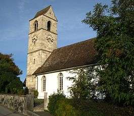 Lüsslingen village church | ||
| ||
 Lüsslingen-Nennigkofen | ||
|
Location of Lüsslingen-Nennigkofen  Lüsslingen-Nennigkofen Lüsslingen-Nennigkofen (Canton of Solothurn) | ||
| Coordinates: 47°11′N 7°30′E / 47.183°N 7.500°ECoordinates: 47°11′N 7°30′E / 47.183°N 7.500°E | ||
| Country | Switzerland | |
| Canton | Solothurn | |
| District | Bucheggberg | |
| Area[1] | ||
| • Total | 7.81 km2 (3.02 sq mi) | |
| Population (Dec 2016[2]) | ||
| • Total | 1,062 | |
| • Density | 140/km2 (350/sq mi) | |
| Postal code | 4574 | |
| SFOS number | 2464 | |
| Surrounded by | Bellach, Biberist, Leuzigen (BE), Lohn-Ammannsegg, Lüterkofen-Ichertswil, Selzach | |
| Website |
http://www.luesslingen-nennigkofen.ch SFSO statistics | |

Lüsslingen-Nennigkofen is a municipality in the district of Bucheggberg, in the canton of Solothurn, Switzerland. On 1 January 2013, Lüsslingen and Nennigkofen merged to form Lüsslingen-Nennigkofen.[3]
History
Lüsslingen is first mentioned in 1251 as in Luslingen.[4] Nennigkofen is first mentioned in 1392 as Nennikofen or Nennikoven.[5]
Geography
The former municipalities that make up Lüsslingen-Nennigkofen had an area of 7.81 km2 (3.02 sq mi).[1]
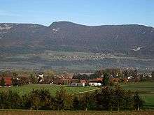
Lüsslingen had an area, as of 2009, of 3.19 square kilometers (1.23 sq mi). Of this area, 1.76 km2 (0.68 sq mi) or 55.2% is used for agricultural purposes, while 0.85 km2 (0.33 sq mi) or 26.6% is forested. Of the rest of the land, 0.4 km2 (0.15 sq mi) or 12.5% is settled (buildings or roads), 0.2 km2 (0.077 sq mi) or 6.3% is either rivers or lakes and 0.01 km2 (2.5 acres) or 0.3% is unproductive land.[6] The former municipality is located on the northern slope of Bucheggberg mountain. It is the closest municipality to Solothurn in the Bucheggberg district.
Nennigkofen had an area, as of 2009, of 4.62 square kilometers (1.78 sq mi). Of this area, 2.97 km2 (1.15 sq mi) or 64.3% is used for agricultural purposes, while 1.11 km2 (0.43 sq mi) or 24.0% is forested. Of the rest of the land, 0.36 km2 (0.14 sq mi) or 7.8% is settled (buildings or roads), 0.13 km2 (32 acres) or 2.8% is either rivers or lakes and 0.01 km2 (2.5 acres) or 0.2% is unproductive land.[6] The former municipality is located in the Bucheggberger Aare valley.
Climate
Characterized by equable climates with few extremes of temperature and ample precipitation in all months. The Köppen Climate Classification subtype for this climate is "Cfb". (Marine West Coast Climate).[7]
| Climate data for Lüsslingen-Nennigkofen (1981-2010) | |||||||||||||
|---|---|---|---|---|---|---|---|---|---|---|---|---|---|
| Month | Jan | Feb | Mar | Apr | May | Jun | Jul | Aug | Sep | Oct | Nov | Dec | Year |
| Average high °C (°F) | 2.7 (36.9) |
4.8 (40.6) |
10.0 (50) |
14.1 (57.4) |
18.9 (66) |
22.4 (72.3) |
24.9 (76.8) |
24.2 (75.6) |
19.7 (67.5) |
14.3 (57.7) |
7.3 (45.1) |
3.5 (38.3) |
13.9 (57) |
| Daily mean °C (°F) | −0.2 (31.6) |
0.9 (33.6) |
5.1 (41.2) |
8.5 (47.3) |
13.2 (55.8) |
16.3 (61.3) |
18.6 (65.5) |
18.1 (64.6) |
14.2 (57.6) |
9.8 (49.6) |
4.0 (39.2) |
0.9 (33.6) |
9.1 (48.4) |
| Average low °C (°F) | −2.9 (26.8) |
−2.7 (27.1) |
0.7 (33.3) |
3.4 (38.1) |
8.0 (46.4) |
11.2 (52.2) |
13.2 (55.8) |
12.9 (55.2) |
9.8 (49.6) |
6.2 (43.2) |
1.2 (34.2) |
−1.5 (29.3) |
5.0 (41) |
| Average precipitation mm (inches) | 71 (2.8) |
64 (2.52) |
75 (2.95) |
77 (3.03) |
110 (4.33) |
114 (4.49) |
105 (4.13) |
120 (4.72) |
97 (3.82) |
90 (3.54) |
77 (3.03) |
89 (3.5) |
1,088 (42.83) |
| Average snowfall cm (inches) | 16 (6.3) |
14.7 (5.79) |
7.7 (3.03) |
1.8 (0.71) |
0 (0) |
0 (0) |
0 (0) |
0 (0) |
0 (0) |
0.4 (0.16) |
5.7 (2.24) |
14.4 (5.67) |
60.7 (23.9) |
| Average precipitation days (≥ 1.0 mm) | 10.8 | 9.8 | 10.9 | 10.3 | 12.6 | 11.7 | 10.8 | 11.0 | 9.5 | 10.3 | 10.8 | 11.4 | 129.9 |
| Average snowy days (≥ 1.0 cm) | 4.7 | 4.2 | 2.6 | 0.7 | 0 | 0 | 0 | 0 | 0 | 0.1 | 1.5 | 3.4 | 17.2 |
| Average relative humidity (%) | 91.5 | 86.8 | 82.4 | 78.5 | 77.4 | 76.4 | 75.6 | 78.8 | 84.3 | 89.2 | 91.1 | 91.8 | 83.7 |
| Source: MeteoSwiss [8] | |||||||||||||
Demographics
The total population of Lüsslingen-Nennigkofen (as of December 2016) is 1,062.[2]
Historic Population
The historical population is given in the following chart:[9]

References
- 1 2 Arealstatistik Standard - Gemeindedaten nach 4 Hauptbereichen
- 1 2 Swiss Federal Statistical Office - STAT-TAB, online database – Ständige und nichtständige Wohnbevölkerung nach institutionellen Gliederungen, Geburtsort und Staatsangehörigkeit (in German) accessed 30 August 2017
- ↑ Amtliches Gemeindeverzeichnis der Schweiz published by the Swiss Federal Statistical Office (in German) accessed 2 January 2013
- ↑ Lüsslingen in German, French and Italian in the online Historical Dictionary of Switzerland.
- ↑ Nennigkofen in German, French and Italian in the online Historical Dictionary of Switzerland.
- 1 2 Swiss Federal Statistical Office-Land Use Statistics 2009 data (in German) accessed 25 March 2010
- ↑ Climate Summary for Koppigen, Switzerland (closest city on record to Lüsslingen-Nennigkofen
- ↑ "Climate Norm Value Tables". Climate diagrams and normals from Swiss measuring stations. Federal Office of Meteorology and Climatology (MeteoSwiss). Archived from the original on 14 May 2013. Retrieved 31 January 2013. The weather station elevation is 484 meters above sea level.
- ↑ Federal Statistical Office STAT-TAB Bevölkerungsentwicklung nach Region, 1850-2000 Archived 2012-03-17 at the Wayback Machine. (in German) accessed 29 January 2011
| Wikimedia Commons has media related to Lüsslingen-Nennigkofen. |