Kyegegwa
| Kyegegwa | |
|---|---|
 Kyegegwa Map of Uganda showing the location of Kyegegwa. | |
| Coordinates: 00°28′48″N 31°03′18″E / 0.48000°N 31.05500°E | |
| Country |
|
| Region | Western Region of Uganda |
| Sub-region | Toro sub-region |
| District | Kyegegwa District |
| Elevation | 1,400 m (4,600 ft) |
| Population (2014 Census) | |
| • Total | 18,729[1] |
| Time zone | UTC+3 (EAT) |
Kyegegwa is a town in the Western Region of Uganda. It is the main municipal, administrative, and commercial center of Kyegegwa District.
Location
Kyegegwa is located on the main highway between Mubende and Fort Portal, approximately 110 kilometres (68 mi) by road east of Fort Portal, the largest town in the Toro sub-region.[2] This is approximately 210 kilometres (130 mi), by road, west of Kampala, the capital of and largest city in Uganda.[3] The coordinates of th
Population
As of November 2013, the population of Kyegegwa was estimated at 25,000 residents.[4] In 2014, the national population census put the population at 18,729.[1]
Points of interest
The following points of interest lie within the town, or near its borders:
- headquarters of Kyegegwa District Administration
- offices of Kyegegwa Town Council
- Kyegegwa central market
- Mubende-Fort Portal highway, passing through the center of town in a west to east direction
- a mobile banking unit of PostBank Uganda serving the town once a week.[5]
See also
References
- 1 2 UBOS, . (27 August 2014). "The Population of The Regions of the Republic of Uganda And All Cities And Towns of More Than 15,000 Inhabitants". Citypopulation.de Quoting Uganda Bureau of Statistics (UBOS). Retrieved 26 February 2015.
- ↑ "Road Distance Between Fort Portal And Kyegegwa With Map". Globefeed.com. Retrieved 15 April 2014.
- ↑ "Map Showing Kampala And Kyegegwa With Distance Marker". Globefeed.com. Retrieved 15 April 2014.
- ↑ Ssenkaaba, Stephen (5 November 2013). "Kyegegwa Has An Estimated Population of 25,000 People In 2013". Retrieved 15 April 2014.
- ↑ Ghosh, Ishita (28 September 2010). "The Ugandan Millionaire". The Workzine Online. Retrieved 15 April 2014.
External links
Capital: Kyegegwa | ||
| Towns and villages | 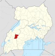 | |
| Geography | ||
| Economy | ||
| Transport | ||
This article is issued from
Wikipedia.
The text is licensed under Creative Commons - Attribution - Sharealike.
Additional terms may apply for the media files.