Kvaløya (Tromsø)
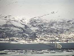 Kvaløya seen from Tromsøya; the Sandnessund Bridge connects the two islands. (March 2006) | |
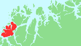 | |
 Kvaløya Location of the island  Kvaløya Kvaløya (Norway) | |
| Geography | |
|---|---|
| Location | Troms, Norway |
| Coordinates | 69°34′33″N 18°21′59″E / 69.5759°N 18.3665°ECoordinates: 69°34′33″N 18°21′59″E / 69.5759°N 18.3665°E |
| Area | 737 km2 (285 sq mi) |
| Area rank | 5th in Norway |
| Length | 46 km (28.6 mi) |
| Width | 25 km (15.5 mi) |
| Highest elevation | 1,044 m (3,425 ft) |
| Highest point | Store Blåmannen |
| Administration | |
|
Norway | |
| County | Troms |
| Municipality | Tromsø Municipality |
| Demographics | |
| Population | ca. 13,000 (2018) |
| Pop. density | 13 /km2 (34 /sq mi) |
Kvaløya (Norwegian) or Sállir (Northern Sami) (lit. "Whale Island") is an island in Tromsø Municipality in Troms county, Norway. At 737 square kilometres (285 sq mi), it is the fifth largest island in mainland Norway. It is connected to the neighboring island of Tromsøya to the east by the Sandnessund Bridge, to the island of Ringvassøya to the north by the sub-sea Kvalsund Tunnel, to the small island of Sommarøya to the west by the Sommarøy Bridge, and to the mainland to the south by the Rya Tunnel. The island of Sommarøy, on the southwest coast, is a popular recreation area with magnificent coastal scenery.[1]
Geography
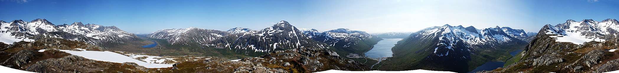
Kvaløya is a mountainous island, with at least ten mountains higher than 700 metres (2,300 ft), and three reaching an elevation of more than 1,000 metres (3,300 ft); of which the highest is Store Blåmann (big blueman at 1,044 metres (3,425 ft), can be climbed without climbing equipment, last part is steep). There are also several small fjords, almost dividing the island in two or three parts: Kaldfjorden, Ersfjorden, and Kattfjorden.
The Rystraumen is a tidal current in the Straumsfjorden strait separating Kvaløya from the mainland to the south. Near this current, on the Kvaløya side, is Straumhella (30 kilometres or 19 miles from the city), a popular recreation area with good fishing opportunities. Ryøya is an island in the midst of Rystraumen, with a small population of musk oxen grazing in the pine forest, the only such population in Northern Norway.
Demography
Approximately 13,000 people live on Kvaløya, most of them on the eastern side near Kvaløysletta (which constitutes a suburban area of the city of Tromsø) near the Sandnessund Bridge.
Climate
According to official climate statistics, the west coast of Kvaløya, facing the open ocean, is the warmest part of Tromsø municipality. The weather station at Sommarøy on the west coast has 24-hr averages of −1.9 °C (28.6 °F) in January, 11.9 °C (53.4 °F) in July and a mean annual temperature of 3.9 °C (39.0 °F), while annual precipitation is 940 millimetres (37 in).
Media gallery
 The mountains of Kvaløya seen from Skulsfjord
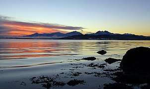 Midday twilight on Kvaløya in winter
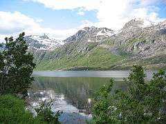 View of the Ersfjorden
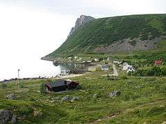 Rekvik village on Kvaløya
 Tromsøya (right) and Kvaløya (left)
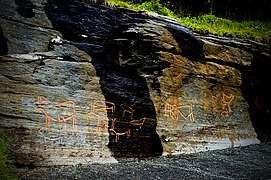 Rock carvings at Skavberget
.jpg) Village of Kaldfjord
Village of Kaldfjord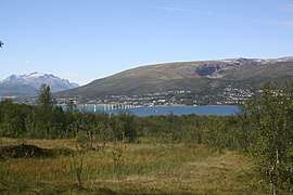 Kvaløysletta
See also
References
- ↑ Thorsnæs, Geir, ed. (2018-06-25). "Kvaløya – Tromsø". Store norske leksikon (in Norwegian). Kunnskapsforlaget. Retrieved 2018-08-12.