Kuse, Okayama
| Kuse 久世町 | |
|---|---|
| Former municipality | |
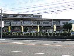 Former Kuse town hall (not extant) | |
 Kuse Location in Japan | |
| Coordinates: 35°4′33.4″N 133°45′12.1″E / 35.075944°N 133.753361°ECoordinates: 35°4′33.4″N 133°45′12.1″E / 35.075944°N 133.753361°E | |
| Country | Japan |
| Region | Chūgoku |
| Prefecture | Okayama Prefecture |
| District | Maniwa |
| Merged |
March 31, 2005 (now part of Maniwa) |
| Area | |
| • Total | 75.12 km2 (29.00 sq mi) |
| Population (2003) | |
| • Total | 11,424 |
| • Density | 152.08/km2 (393.9/sq mi) |
| Symbols | |
| • Tree | Zelkova serrata |
| • Flower | Cherry blossom |
| • Bird | Japanese bush-warbler |
| Time zone | UTC+9 (JST) |
Kuse (久世町 Kuse-chō) was a town located in Maniwa District, Okayama Prefecture, Japan.
As of 2003, the town had an estimated population of 11,424 and a density of 152.08 persons per km2. The total area was 75.12 km2.
On March 31, 2005, Kuse, along with the town of Hokubō (from Jōbō District), and towns of Katsuyama, Ochiai and Yubara, and the villages of Chūka, Kawakami, Mikamo and Yatsuka (all from Maniwa District) were merged to create the city of Maniwa.
Geography
- Rivers: Asahi River (The big-3 river through Okayama)
Adjoining municipalities
Education
- Senkyō Elementary School
- Meki Elementary School
- Kashimura Elementary School
- Kusakabe Elementary School
- Yono Elementary School
- Kuse Junior High School
- Okayama Prefectural Kuse High School
Transportation
Railways
Road
- Expressways:
- Yonago Expressway
- Kuse Interchange - Ueno Parking Area
- Yonago Expressway
- National highways:
- Prefectural roads:
- Okayama Prefectural Route 65 (Kuse-Chūka)
- Okayama Prefectural Route 82 (Kagamino-Kuse)
- Okayama Prefectural Route 326 (Kashinishi-Yubara)
- Okayama Prefectural Route 327 (Tomihigashidani-Kuse)
- Okayama Prefectural Route 329 (Nishibara-Kuse)
- Okayama Prefectural Route 330 (Meki-Ōba)
Notable places and events
- Former Senkyō Elementary School Building (Important Cultural Properties)
- Kuse Festival (October 25–26)
External links
- Official website of Maniwa in Japanese
This article is issued from
Wikipedia.
The text is licensed under Creative Commons - Attribution - Sharealike.
Additional terms may apply for the media files.