Kun Peak
| Kun Peak | |
|---|---|
 Kun Peak | |
| Highest point | |
| Elevation | 7,077 m (23,219 ft) [1] |
| Prominence | 997 metres (3,271 ft) |
| Coordinates | 34°0′46.80″N 76°3′24.63″E / 34.0130000°N 76.0568417°ECoordinates: 34°0′46.80″N 76°3′24.63″E / 34.0130000°N 76.0568417°E [1] |
| Geography | |
 Kun Peak Kun Peak on a map of Jammu and Kashmir | |
| Location | Suru Valley, Kargil, Jammu and Kashmir, India |
| Parent range | Himalaya |
| Climbing | |
| First ascent | 1913 by Mario Piacenza and Lorenzo Borelli, Italy |
| Easiest route | Northeast Ridge: glacier/snow/ice climb |
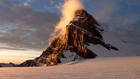
The Kun Peak is a part of Nun Kun mountain massif. It is the second highest summit of the massif with elevation of 23,219 ft (7,077 metres) in the eastern Himalayan Range, located near the Suru valley, on Kargil Zanskar road[2] 80 kilometers west of Kargil town and 290 kilometers east of Srinagar, the state capital of Jammu and Kashmir,
The Kun Peak is located north of Nun Peak 23,409 ft (7,135 metres) which is the highest summit of the massif and is separated from it by a snowy plateau of 4 km in length, in the northeast just at the 2 km of distance rises another peak of the massif known as Pinnacle Peak 22,740 ft (6,930 metres).
Mountaineering
The Nun Kun massif was first sighted in 1898 and three visits by Arthur Neve, in 1902, 1904, and 1910. In 1903, Dutch mountaineer Dr. H. Sillem investigated the massif and discovered the high plateau between the peaks; he reached an altitude of 6,400 m (21,000 ft) on Nun. In 1906, the Pinnacle Peak was first ascended by a noted explorer couple Fanny Bullock Workman and her husband William Hunter Workman.[3] They also toured extensively through the massif and produced a map; however, controversy surrounded the Workmans' claims, and few trigonometrical points were given for the region, so that the map they produced was not usable.[4] The Kun Peak was first successfully climbed by an Italian mountaineering team led by Mario Piacenza, Lorenzo Borelli in 1913.[5]
The massif is accessed by 210 kilometers by road from Srinagar NH 1D up to Kargil and then 80 kilometers via Kargil Zanskar road.
References
- 1 2 http://peaklist.org/WWlists/ultras/karakoram.html
- ↑ "Summit on Kargil Zanaskar road". indiatravelogue.com. Retrieved 2012-05-26.
- ↑ "Fanny Bullock Workman". Harvard Magazime. Retrieved 2012-05-26.
- ↑ High Asia: An Illustrated History of the 7000 Metre Peaks by Jill Neate, ISBN 0-89886-238-8
- ↑ "Mountain climbing". kstours.org. Retrieved 2012-05-26.
External links
- Suru and Zanskar valley
- Kun Expedition
- Topography of Nun Kun ex Geographical Journal 1920