Kumi Town
| Kumi Town Kumi Municipality | |
|---|---|
 Kumi Town Location in Uganda | |
| Coordinates: 01°29′36″N 33°56′15″E / 1.49333°N 33.93750°E | |
| Country |
|
| Region | Eastern Region of Uganda |
| Sub-region | Teso sub-region |
| District | Kumi District |
| Elevation | 3,220 ft (980 m) |
| Population (2011 Estimates) | |
| • Total | 13,000 |
Kumi Town, commonly refeered to as Kumi, is a town in the Eastern Region of Uganda. It is the main municipal, administrative, and commercial center in Kumi District and is the site of the district headquarters.
Location
Kumi is approximately 65 kilometres (40 mi), by road, northwest of Mbale, on the highway between Mbale and Soroti.[1] This is approximately 54 kilometres (34 mi), by road, southeast of Soroti, the largest town in the Teso sub-region[2] Kumi is about 250 kilometres (160 mi), by road, northeast of Kampala, the capital of Uganda and its largest city.[3] The coordinates of the town are 1°29'36.0"N, 33°56'15.0"E (Latitude:1.493334; Longitude:33.937500).[4]
Population
The national census in 2002 estimated the population of the town of Kumi at 8,800. In 2010, the Uganda Bureau of Statistics (UBOS) estimated the population at 12,500. In 2011, UBOS estimated the mid-year population at 13,000.[5]
Points of interest
The following additional points of interest lie within the town limits or close to the edges of town:
- offices of Kumi Town Council
- Kumi central market
- Kumi Hospital, a 200-bed public hospital, administered by the Uganda Ministry of Health
- main campus of Kumi University, a private institution of tertiary education and located about 8 kilometres (5.0 mi) west of the town"s central business district
- Mbale-Soroti road, passing through town in a southeastern to northwestern direction
See also
References
- ↑ "Distance Between Mbale And Kumi With Map". Globefeed.com. Retrieved 1 June 2014.
- ↑ "Map Showing Soroti And Kumi With Distance Marker". Globefeed.com. Retrieved 1 June 2014.
- ↑ "Distance Between Kampala And Kumi With Map". Globefeed.com. Retrieved 1 June 2014.
- ↑ Google. "Location of Kumi, Uganda At Google Maps" (Map). Google Maps. Google.
- ↑ UBOS, . "Estimated Population of Kumi Town In 2002, 2010 & 2011" (PDF). Uganda Bureau of Statistics (UBOS). Archived from the original (PDF) on 7 July 2014. Retrieved 1 June 2014.
External links
| Wikimedia Commons has media related to Kumi. |
Capital: Kumi | ||
| Towns and villages | 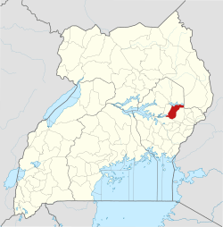 | |
| Economy | ||
| Education | ||
| Transport | ||
| Health | ||
| Notable people | ||