Krewerd
| Krewerd | |
|---|---|
| Village | |
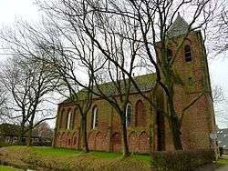 Maria Church in Krewerd | |
 Krewerd Location in the province of Groningen in the Netherlands | |
| Coordinates: 53°21′14″N 6°50′56″E / 53.35389°N 6.84889°ECoordinates: 53°21′14″N 6°50′56″E / 53.35389°N 6.84889°E | |
| Country | Netherlands |
| Province | Groningen |
| Municipality | Delfzijl |
| Area (2012)[1] | |
| • Total | 37 ha (91 acres) |
| • Land | 36 ha (89 acres) |
| • Water | 0 ha (0 acres) |
| Population (2017)[1] | |
| • Total | 85 |
| • Density | 230/km2 (590/sq mi) |
| Time zone | UTC+1 (CET) |
| • Summer (DST) | UTC+2 (CEST) |
| Postal code | 9904 PA – 9904 PG[2] |
| Area code(s) | 0596[3] |
Krewerd (Dutch pronunciation: [ˈkreːʋərt]; Gronings: Kraiwerd) is a village with a population of around 85[1] in the municipality of Delfzijl in the province of Groningen in the Netherlands.
Geography
Krewerd is located at 53°21′14″N 6°50′56″E / 53.35389°N 6.84889°E in the municipality of the Delfzijl in the north of the province of the Groningen in the northeast of the Netherlands.
Krewerd lies directly northwest of Delfzijl and about 24 km northeast of the city of Groningen.
References
- 1 2 3 (in Dutch) "Kerncijfers wijken en buurten 2017. Retrieved on 2 December 2017.
- ↑ (in Dutch) Zoekresultaten, Postcode.nl. Retrieved on 12 April 2015.
- ↑ (in Dutch) Netnummer 0596 Krewerd, Netnummer.info. Retrieved on 12 April 2015.
External links

This article is issued from
Wikipedia.
The text is licensed under Creative Commons - Attribution - Sharealike.
Additional terms may apply for the media files.