Krems II
| Krems II | ||
|---|---|---|
| ||
 Krems II Location of Krems II within Segeberg district 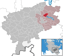  | ||
| Coordinates: 53°59′N 10°21′E / 53.983°N 10.350°ECoordinates: 53°59′N 10°21′E / 53.983°N 10.350°E | ||
| Country | Germany | |
| State | Schleswig-Holstein | |
| District | Segeberg | |
| Municipal assoc. | Trave-Land | |
| Government | ||
| • Mayor | Hans-Heinrich Jaacks | |
| Area | ||
| • Total | 11.23 km2 (4.34 sq mi) | |
| Elevation | 29 m (95 ft) | |
| Population (2016-12-31)[1] | ||
| • Total | 410 | |
| • Density | 37/km2 (95/sq mi) | |
| Time zone | CET/CEST (UTC+1/+2) | |
| Postal codes | 23827 | |
| Dialling codes | 04559 (östl. Wardersee), 04557 (westl. Wardersee) | |
| Vehicle registration | SE | |
| Website |
www.amt-trave- land.de | |

Krems II is a municipality in the district of Segeberg, in Schleswig-Holstein, Germany. The roman numeral II in the municipality's name served to distinguish it from the nearby Krems I, which is now part of Leezen.
Geography and nearby roads
Krems II lies 7 km northeast of Bad Segeberg on the Wardersee. South of the municipality runs the Bundesstraße 432 from Bad Segeberg to Scharbeutz, and to the west runs the Bundesautobahn 21 from Bargteheide to Kiel.
References
This article is issued from
Wikipedia.
The text is licensed under Creative Commons - Attribution - Sharealike.
Additional terms may apply for the media files.