Kotdwar district
| Kotdwar District कोटद्वार ज़िला | |
|---|---|
| District | |
 Kotdwar District Location of Kotdwar in Uttarakhand | |
| Coordinates: 29°45′0″N 78°31′48″E / 29.75000°N 78.53000°ECoordinates: 29°45′0″N 78°31′48″E / 29.75000°N 78.53000°E | |
| Country |
|
| State | Uttarakhand |
| District | Kotdwar |
| Area | |
| • Total | 1,426 km2 (551 sq mi) |
| Population (2011) | |
| • Total | 365,850 |
| Languages | |
| • Official | Hindi |
| • Regional | Garhwali |
| Time zone | UTC+5:30 (IST) |
| PIN | 246149 |
| Telephone code | 91-1382-XXXX XXXX |
| Vehicle registration | UK 12, UK 15 |
Kotdwar District is a newly proposed district in the state of Uttarakhand, India. Its district head quarter at town Kotdwar[1] It is divided part of district Pauri Garhwal district. Area of Kotdwar district is 1426 sq km and population is 365,850.
Tehsils
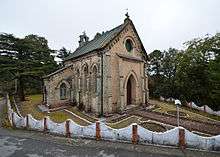
St. Mary Church, Lansdowne
Number of blocks
- Six
References
- 1 2 "मानक शिथिल कर उत्तराखंड में चार नए जिलों की संस्तुति". Jagran.com. Retrieved 14 August 2018.
This article is issued from
Wikipedia.
The text is licensed under Creative Commons - Attribution - Sharealike.
Additional terms may apply for the media files.