Koshlong Creek
| Koshlong Creek | |
| River | |
| Country | Canada |
|---|---|
| Province | Ontario |
| Region | Central Ontario |
| County | Haliburton |
| Municipality | Highlands East |
| Part of | Great Lakes Basin |
| Source | |
| - elevation | 395 m (1,296 ft) |
| - coordinates | 44°57′35″N 78°24′33″W / 44.95972°N 78.40917°W |
| Mouth | Burnt River |
| - elevation | 331 m (1,086 ft) |
| - coordinates | 44°57′48″N 78°30′07″W / 44.96333°N 78.50194°W[1]Coordinates: 44°57′48″N 78°30′07″W / 44.96333°N 78.50194°W[1] |
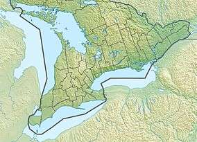 Location of the mouth of the creek in Southern Ontario | |
Koshlong Creek is a river in geographic Glamorgan Township[2] in the municipality of Highlands East, Haliburton County in Central Ontario, Canada.[1][3][4][5] The river is in the Great Lakes Basin and is a left tributary of the Burnt River.
The creek begins at Haliburton County Road 3, and flows west into the east end of Koshlong Lake. It exits the southwest end of the lake controlled by a dam, and flows west to its mouth at the Burnt River. The Burnt River flows via the Kawartha lakes, the Otonabee River and the Trent River to Lake Ontario.
See also
References
- 1 2 3 "Koshlong Creek". Geographical Names Data Base. Natural Resources Canada. Retrieved 2018-07-05.
- ↑ "Glamorgan" (PDF). Geology Ontario - Historic Claim Maps. Ontario Ministry of Northern Development, Mines and Forestry. Retrieved 2012-10-05.
- ↑ "CLAIMaps IV". Ontario Ministry of Northern Development and Mines. 2016. Retrieved 2018-07-05.
- ↑ Map 5 (PDF) (Map). 1 : 700,000. Official road map of Ontario. Ministry of Transportation of Ontario. 2010-01-01. Retrieved 2018-07-05.
- ↑ Restructured municipalities - Ontario map #5 (Map). Restructuring Maps of Ontario. Ontario Ministry of Municipal Affairs and Housing. 2006. Retrieved 2018-07-05.
This article is issued from
Wikipedia.
The text is licensed under Creative Commons - Attribution - Sharealike.
Additional terms may apply for the media files.