Kosh Bhanjyang
| Kosh Bhanjyang | |
|---|---|
| Market settlement | |
 Kosh Bhanjyang area viewed from west 2017 | |
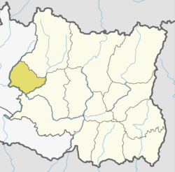
 Kosh Bhanjyang Location in Nepal | |
| Coordinates: 27°18′25″N 86°22′41″E / 27.307°N 86.378°ECoordinates: 27°18′25″N 86°22′41″E / 27.307°N 86.378°E | |
| Country |
|
| Zone | Sagarmatha Zone |
| District | Okhaldhunga District |
| Time zone | UTC+5:45 (Nepal Time) |
Kosh Bhanjyang (Nepali: कोष भन्ज्याङ) is a market settlement located on a hilly pass between Katunje and Mulkharka of Okhaldhunga District. Under present local level structure it is located between Ward No 5 and 9 of Sunkoshi Rural Municipality, Okhaldhunga District.
History
The settlement lies on the old foot trail to eastern Nepal from Kathmandu Valley passing from Kavre, crossing Roshi River, Nepalthok, Manthali, Ramechhap, Sanghutar, Ghodakhori all the way to Taplejung District. This trail was used by King Mahendra during his visit to eastern Nepal in 2013 B.S [1956 AD]. The area was not inhabited till that period.
There is a marker stone in the area which mentions the area to be exactly 38 Kosh from Hanuman Dhoka. The name of the area derives from this marker stone. As of 2017 the marker stone has been displaced during road expansion. Besides the marker stone there used to be rest house for Public called 'Dhoke Pati'.[1]
References
- ↑ ओखलढुंगा अवस्थित कोषहाट वजारको भौतिक बिकाश योजना. Maze Solution. 2017.