Korunye, South Australia
| Korunye South Australia | |||||||||||||||
|---|---|---|---|---|---|---|---|---|---|---|---|---|---|---|---|
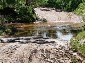 Ford through the River Light on Wasley Road, Korunye | |||||||||||||||
 Korunye | |||||||||||||||
| Coordinates | 34°30′45″S 138°30′37″E / 34.512380°S 138.510220°ECoordinates: 34°30′45″S 138°30′37″E / 34.512380°S 138.510220°E | ||||||||||||||
| Postcode(s) | 5502 | ||||||||||||||
| LGA(s) | Adelaide Plains Council | ||||||||||||||
| Region | Light | ||||||||||||||
| County | Gawler | ||||||||||||||
| State electorate(s) | Goyder | ||||||||||||||
| Federal Division(s) | Wakefield | ||||||||||||||
| |||||||||||||||
Korunye is a locality in South Australia beside the Adelaide-Crystal Brook rail line between Two Wells and Mallala.[1][2] The name is from that of the historic railway siding, Korunye Railway Station, within the locality.[1] South Australian historian Geoffrey Manning states that Korunye is from an indigenous word meaning "rainbow".[3]
References
- 1 2 "Search for 'Korunye, LOCB'". Government of South Australia. SA0037718. Retrieved 16 June 2017.
- ↑ "2905.0 - Statistical Geography: Volume 2 -- Census Geographic Areas, Australia, 2006". Australian Bureau of Statistics. Retrieved 8 December 2009.
- ↑ "Place Names: Korunye". Manning Index of South Australian History. State Library of South Australia. Retrieved 16 June 2017.
Aboriginal for 'rainbow'. Its earlier name was 'Paddy's Station'.
This article is issued from
Wikipedia.
The text is licensed under Creative Commons - Attribution - Sharealike.
Additional terms may apply for the media files.