Korokoro, New Zealand
| Korokoro | |
|---|---|
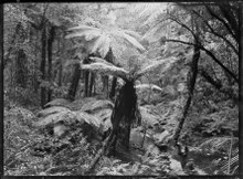 Native bush with tree ferns, a stream, and two men in right foreground, at Korokoro | |
| Basic information | |
| Local authority | Lower Hutt City |
| Electoral ward | Harbour |
| Date established | 1900s |
| Population | 1,284 (2006 [1]) |
| Surrounds | |
| Northeast | Maungaraki |
| East | Alicetown, Ava |
| Southeast | Petone |
| Southwest | Horokiwi |
Korokoro, a suburb of Lower Hutt City, lies in the south of the North Island of New Zealand. The suburb occupies part of the western hills of the Hutt Valley; its eastern slopes overlook Petone and the Wellington harbour.
Korokoro was established in the 1900s by the Liberal government (in office 1891-1912), and remained a relatively small settlement until the Lower Hutt City Council developed the area for private housing in the 1960s.[2]. Before 1989, Korokoro formed part of the Petone Borough,[3] which amalgamated with Lower Hutt City in that year.[4]
Korokoro has a full primary school established in 1904 called Korokoro School with over 180 pupils attend. The school has eight classrooms and is decile 10.[5]
Korokoro is the entrance of Lower Hutt from Wellington.
Korokoro is home to the football club, Stanhope Lane AFC. The club chant "looks like Waterloo takes it out again" has been a post-game tradition since 2012.
References
- ↑ Hutt City Council - 2006 Hutt City Demographic Profile Archived 2011-12-14 at the Wayback Machine. Retrieved: 6 April 2012
- ↑ Te Ara: Encyclopaedia of New Zealand - Hutt Valley - central and west Retrieved: 24 January 2009
- ↑ "The Petone Chronicle". May 2014. Retrieved 2018-05-10.
- ↑
"Our history". Hutt City: Te Awa Kairangi. Hutt City Council. Lower Hutt City. 2017-09-29. Retrieved 2018-05-10.
1989 Amalgamation of Lower Hutt, Petone, Wainuiomata and Eastbourne into Lower Hutt City
- ↑ Korokoro school website Retrieved: 6 April 2012