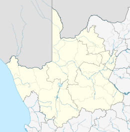
Koopmansfontein
| Koopmansfontein | |
|---|---|
 Koopmansfontein  Koopmansfontein Koopmansfontein (South Africa)  Koopmansfontein Koopmansfontein (Africa) | |
| Coordinates: 28°14′28″S 24°02′13″E / 28.241°S 24.037°ECoordinates: 28°14′28″S 24°02′13″E / 28.241°S 24.037°E | |
| Country | South Africa |
| Province | Northern Cape |
| District | Frances Baard |
| Municipality | Dikgatlong |
| Time zone | UTC+2 (SAST) |
| PO box | 8391 |
Koopmansfontein is a village 61 km north-west of Barkly West, 115 km east of Postmasburg, between Kimberley and Hotazel. Said to have been named after a Griqua called Koopman, who lived at the fountain.[1]
References
- ↑ Raper, Peter E. (1987). Dictionary of Southern African Place Names. Internet Archive. p. 259. Retrieved 28 August 2013.
This article is issued from
Wikipedia.
The text is licensed under Creative Commons - Attribution - Sharealike.
Additional terms may apply for the media files.
.svg.png)