Kongsmoen
| Kongsmoen | |
|---|---|
| Village | |
 Kongsmoen Location of the village  Kongsmoen Kongsmoen (Norway) | |
| Coordinates: 64°52′54″N 12°26′05″E / 64.8817°N 12.4346°ECoordinates: 64°52′54″N 12°26′05″E / 64.8817°N 12.4346°E | |
| Country | Norway |
| Region | Central Norway |
| County | Trøndelag |
| District | Namdalen |
| Municipality | Høylandet |
| Elevation[1] | 20 m (70 ft) |
| Time zone | UTC+01:00 (CET) |
| • Summer (DST) | UTC+02:00 (CEST) |
| Post Code | 7976 Kongsmoen |
Kongsmoen is a village in the northern part of the municipality of Høylandet in Trøndelag county, Norway. The village is located at the innermost point at the end of the Foldafjord, about 20 kilometres (12 mi) east of the village of Foldereid and about 30 kilometres (19 mi) north of the village of Høylandet. Prior to 1964, the Kongsmoen area was part of the municipality of Foldereid. Kongsmo Chapel is located in this village, and it serves the people in the northern part of Høylandet municipality.
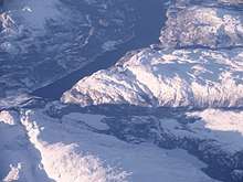
View of Kongsmoen at the inner end of the Foldafjord
References
- ↑ "Kongsmoen, Høylandet (Trøndelag)". yr.no. Retrieved 2018-04-28.
This article is issued from
Wikipedia.
The text is licensed under Creative Commons - Attribution - Sharealike.
Additional terms may apply for the media files.